Area Overview for EX31 4AQ
Photos of EX31 4AQ
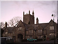
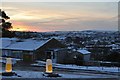
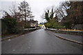

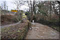


100 photos from this area
Area Information
Key information about the EX31 4AQ including its size, population, and administrative classification.
- Area Type
- Postcode
- Area Size
- 3.9 hectares
- Population
- 1695
- Population Density
- 1108 people/km²
House Prices in EX31 4AQ
32
Properties
£185,812
Average Sold Price
£60,000
Lowest Price
£315,000
Highest Price
Showing 32 properties
| Address | Type | Beds | Baths | Last Sale Price | Last Sale Date | |
|---|---|---|---|---|---|---|
| 34 Windsor Road, Barnstaple, EX31 4AQ | Bungalow | 2 | 1 | £260,000 | Feb 2024 | |
| 24 Windsor Road, Barnstaple, EX31 4AQ | Terraced | 2 | 1 | £235,000 | Mar 2023 | |
| 22 Windsor Road, Barnstaple, EX31 4AQ | Terraced | 2 | 1 | £227,500 | Dec 2022 | |
| 26 Windsor Road, Barnstaple, EX31 4AQ | house | - | - | £238,200 | Jul 2022 | |
| 18 Windsor Road, Barnstaple, EX31 4AQ | Terraced | 2 | 1 | £224,200 | Apr 2022 | |
| 10 Windsor Road, Barnstaple, EX31 4AQ | Semi-detached | 2 | - | £230,000 | Feb 2020 | |
| 4 Windsor Road, Barnstaple, EX31 4AQ | Bungalow | - | - | £210,000 | Sep 2019 | |
| 46 Windsor Road, Barnstaple, EX31 4AQ | Semi-detached | 2 | 1 | £229,950 | Jun 2019 | |
| 44 Windsor Road, Barnstaple, EX31 4AQ | Semi-detached | 2 | 1 | £193,000 | May 2019 | |
| 56 Windsor Road, Barnstaple, EX31 4AQ | Terraced | 3 | 1 | £205,000 | Sep 2018 |
Page 1 of 4
Energy Efficiency in EX31 4AQ
Amenities
Schools
| Rank | School | Type | Entry gender | Ages |
|---|
Explore more schools in this area
Go to Schools tabDemographics
Household Size
One person
most common
Accommodation Type
Houses
most common
Tenure
78
majority
Ethnic Group
White
most common
Religion
N/A
most common
Household Composition
N/A
most common
Age
47
median
Adults (30-64 years)
most common
Household Deprivation
N/A
with no deprivation
NS-SEC
28
in Lower managerial occupations
Explore more demographic insights in this area
Go to Demographics tabPlanning
Planning Constraints
- Flood RiskPremium
- Ramsar Wetland SitesPremium
- Area of Outstanding Natural BeautyPremium
- Protected Nature ReservePremium
- Protected WoodlandPremium