Area Overview for EX31 3LT
Photos of EX31 3LT
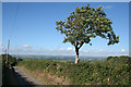
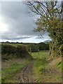

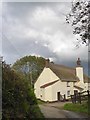
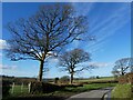
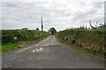
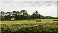
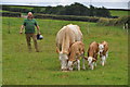
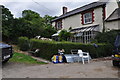
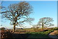
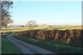
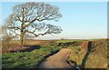
13 photos from this area
Area Information
Key information about the EX31 3LT including its size, population, and administrative classification.
- Area Type
- Postcode
- Area Size
- 61.3 hectares
- Population
- 1883
- Population Density
- 37 people/km²
House Prices in EX31 3LT
8
Properties
£365,000
Average Sold Price
£185,000
Lowest Price
£660,000
Highest Price
Showing 8 properties
| Address | Type | Beds | Baths | Last Sale Price | Last Sale Date | |
|---|---|---|---|---|---|---|
| Higher Delworthy, Road From Easton Moor Cross To Rooks Cross, Yarnscombe, EX31 3LT | Detached | 2 | - | £660,000 | Oct 2022 | |
| Walnut Tree Cottage, Road From Easton Moor Cross To Rooks Cross, Yarnscombe, EX31 3LT | Terraced | 2 | - | £195,000 | Sep 2020 | |
| Wrens Nest Cottage, Road From Easton Moor Cross To Rooks Cross, Yarnscombe, EX31 3LT | Terraced | 2 | 1 | £185,000 | Jan 2020 | |
| Kings Topp, Road From Easton Moor Cross To Rooks Cross, Yarnscombe, EX31 3LT | Detached | 3 | 3 | £420,000 | Jul 2015 | |
| Threshing Barn, Road From Easton Moor Cross To Rooks Cross, Yarnscombe, EX31 3LT | Terraced | 1 | - | - | - | |
| Lower Delworthy, Road From Easton Moor Cross To Rooks Cross, Yarnscombe, EX31 3LT | Detached | 3 | 2 | - | - | |
| Former Annexe, Higher Delworthy, Road From Easton Moor Cross To Rooks Cross, Yarnscombe, EX31 3LT | Flat | - | - | - | - | |
| Boode Farm, Road From Easton Moor Cross To Rooks Cross, Yarnscombe, EX31 3LT | house | - | - | - | - |
Energy Efficiency in EX31 3LT
Amenities
Schools
| Rank | School | Type | Entry gender | Ages |
|---|
Explore more schools in this area
Go to Schools tabDemographics
Household Size
Two person
most common
Accommodation Type
Houses
most common
Tenure
81
majority
Ethnic Group
White
most common
Religion
N/A
most common
Household Composition
N/A
most common
Age
47
median
Adults (30-64 years)
most common
Household Deprivation
N/A
with no deprivation
NS-SEC
34
in Lower managerial occupations
Explore more demographic insights in this area
Go to Demographics tabPlanning
Planning Constraints
- Flood RiskPremium
- Ramsar Wetland SitesPremium
- Area of Outstanding Natural BeautyPremium
- Protected Nature ReservePremium
- Protected WoodlandPremium