Area Overview for EX31 2PN
Photos of EX31 2PN
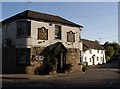
100 photos from this area
Area Information
Key information about the EX31 2PN including its size, population, and administrative classification.
- Area Type
- Postcode
- Area Size
- 5821 m²
- Population
- 1626
- Population Density
- 265 people/km²
House Prices in EX31 2PN
14
Properties
£222,395
Average Sold Price
£104,950
Lowest Price
£310,000
Highest Price
Showing 14 properties
| Address | Type | Beds | Baths | Last Sale Price | Last Sale Date | |
|---|---|---|---|---|---|---|
| 6 Regent Close, Fremington, EX31 2PN | Bungalow | 2 | - | £310,000 | Feb 2022 | |
| 7 Regent Close, Fremington, EX31 2PN | Bungalow | - | - | £285,000 | Dec 2020 | |
| 11 Regent Close, Fremington, EX31 2PN | Bungalow | 2 | - | £264,950 | Oct 2020 | |
| 5 Regent Close, Fremington, EX31 2PN | Bungalow | 2 | 1 | £276,950 | Apr 2020 | |
| 12 Regent Close, Fremington, EX31 2PN | Bungalow | - | - | £230,000 | Aug 2018 | |
| 4 Regent Close, Fremington, EX31 2PN | Bungalow | - | - | £247,500 | Oct 2016 | |
| 2 Regent Close, Fremington, EX31 2PN | Bungalow | 2 | 1 | £175,000 | Dec 2013 | |
| 1 Regent Close, Fremington, EX31 2PN | Bungalow | 2 | - | £180,000 | Nov 2011 | |
| 9 Regent Close, Fremington, EX31 2PN | Bungalow | 2 | - | £187,000 | Aug 2010 | |
| 13 Regent Close, Fremington, EX31 2PN | Bungalow | - | - | £185,000 | Mar 2004 |
Page 1 of 2
Energy Efficiency in EX31 2PN
Amenities
Schools
| Rank | School | Type | Entry gender | Ages |
|---|
Explore more schools in this area
Go to Schools tabDemographics
Household Size
Two person
most common
Accommodation Type
Houses
most common
Tenure
86
majority
Ethnic Group
White
most common
Religion
N/A
most common
Household Composition
N/A
most common
Age
47
median
Elderly (65+ years)
most common
Household Deprivation
N/A
with no deprivation
NS-SEC
34
in Lower managerial occupations
Explore more demographic insights in this area
Go to Demographics tabPlanning
Planning Constraints
- Flood RiskPremium
- Ramsar Wetland SitesPremium
- Area of Outstanding Natural BeautyPremium
- Protected Nature ReservePremium
- Protected WoodlandPremium