Area Overview for EX31 2FE
Photos of EX31 2FE


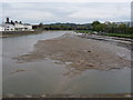


100 photos from this area
Area Information
Key information about the EX31 2FE including its size, population, and administrative classification.
- Area Type
- Postcode
- Area Size
- 4.0 hectares
- Population
- 1394
- Population Density
- 1345 people/km²
House Prices in EX31 2FE
59
Properties
£384,933
Average Sold Price
£195,000
Lowest Price
£510,000
Highest Price
Showing 59 properties
| Address | Type | Beds | Baths | Last Sale Price | Last Sale Date | |
|---|---|---|---|---|---|---|
| 142 Taw Wharf, Sticklepath, EX31 2FE | Flat | 1 | 1 | £195,000 | Sep 2025 | |
| 117 Taw Wharf, Sticklepath, EX31 2FE | Flat | - | - | £195,000 | May 2025 | |
| 153 Taw Wharf, Sticklepath, EX31 2FE | house | - | - | £485,000 | Apr 2025 | |
| 170 Taw Wharf, Sticklepath, EX31 2FE | Terraced | 2 | 1 | £315,000 | Oct 2024 | |
| 137 Taw Wharf, Sticklepath, EX31 2FE | Terraced | 4 | 3 | £476,000 | Sep 2024 | |
| 120 Taw Wharf, Sticklepath, EX31 2FE | Flat | - | - | £318,000 | Sep 2024 | |
| 171 Taw Wharf, Sticklepath, EX31 2FE | Terraced | 2 | 1 | £300,000 | Feb 2024 | |
| 165 Taw Wharf, Sticklepath, EX31 2FE | Terraced | 3 | 2 | £380,000 | May 2023 | |
| 125 Taw Wharf, Sticklepath, EX31 2FE | house | - | - | £470,000 | Apr 2023 | |
| 138 Taw Wharf, Sticklepath, EX31 2FE | house | - | - | £510,000 | Apr 2023 |
Page 1 of 6
Energy Efficiency in EX31 2FE
Amenities
Schools
| Rank | School | Type | Entry gender | Ages |
|---|
Explore more schools in this area
Go to Schools tabDemographics
Household Size
Two person
most common
Accommodation Type
Houses
most common
Tenure
83
majority
Ethnic Group
White
most common
Religion
N/A
most common
Household Composition
N/A
most common
Age
47
median
Adults (30-64 years)
most common
Household Deprivation
N/A
with no deprivation
NS-SEC
33
in Lower managerial occupations
Explore more demographic insights in this area
Go to Demographics tabPlanning
Planning Constraints
- Flood RiskPremium
- Ramsar Wetland SitesPremium
- Area of Outstanding Natural BeautyPremium
- Protected Nature ReservePremium
- Protected WoodlandPremium