Area Overview for EX31 1SB
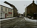
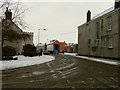
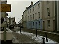
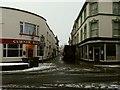
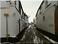
Photos of EX31 1SB


Area Information
Living in EX31 1SB means being part of a tightly packed residential cluster in England, where 1,684 people reside across 856 square metres. The area’s density is striking — over 1.9 million people per square kilometre — creating a compact, closely knit community. This postcode is not a sprawling suburb but a small, defined space where daily life revolves around nearby amenities and local connections. With a median age of 47, the population skews toward adults aged 30–64, suggesting a mix of established residents and families. The area’s character is shaped by its proximity to transport hubs and retail options, though its small size means every resident is within walking distance of key services. While the high density might feel limiting, it also fosters a sense of familiarity and accessibility. For those prioritising convenience over space, EX31 1SB offers a compact, functional living environment with minimal commute times to nearby towns. However, the area’s small footprint means its appeal is niche — ideal for those seeking a focused, low-maintenance lifestyle but less suited to larger households.
- Area Type
- Postcode
- Area Size
- 856 m²
- Population
- 1684
- Population Density
- 4182 people/km²
The property market in EX31 1SB is characterised by a low home ownership rate of 23%, suggesting that the area is not a traditional owner-occupied community but rather a rental-focused zone. The accommodation type is entirely flats, which is unusual for a postcode of this size. This indicates a lack of detached or semi-detached housing, likely due to the area’s compact nature and planning constraints. For buyers, this means limited options for purchasing property, with most available homes being flats in multi-unit buildings. The high population density and small footprint of the area also mean that the surrounding regions may offer more varied housing stock. However, the low home ownership rate could signal a transient population or economic factors that discourage long-term investment. Prospective buyers should consider whether the area’s rental-centric model aligns with their goals, particularly if they prioritise property ownership or family-sized homes.
House Prices in EX31 1SB
No properties found in this postcode.
Energy Efficiency in EX31 1SB
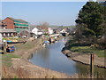
The lifestyle in EX31 1SB is defined by proximity to retail, transport, and coastal access. Residents can shop at Spar, Tesco Barnstaple, and M&S Barnstaple, ensuring daily essentials are within walking distance. Rail links to Barnstaple and Chapelton stations provide easy access to regional hubs, while the Royal Marines Base Chivenor Airport caters to those needing regional flights. For those seeking alternative travel, Instow and Appledore ferry landings offer connections to nearby coastal towns, enhancing the area’s appeal for commuters or leisure travelers. The compact nature of the postcode means amenities are tightly clustered, reducing the need for long journeys. However, the absence of parks or leisure facilities within the area itself suggests that residents must venture to nearby towns for recreational activities. The mix of retail, transport, and ferry options creates a practical, convenience-driven lifestyle, though it lacks the green spaces or cultural amenities that might attract others.
Amenities
Schools
Residents of EX31 1SB have access to two primary schools: Ashleigh CofE (VC) Primary School and Ashleigh CofE Primary School, which shares the same name but is listed separately. Both are primary schools, though only one carries an Ofsted rating of ‘good’. This suggests a limited range of educational options for young children, with no secondary schools or specialist provision mentioned. The duplication of school names may indicate a single institution with multiple sites or administrative oversight. For families, the availability of two primary schools within the area is a practical advantage, reducing the need for long commutes. However, the lack of diversity in school types — with no mention of secondary or special needs education — means parents may need to look beyond the immediate postcode for comprehensive schooling. The ‘good’ Ofsted rating for one school provides a positive benchmark, but the overall educational landscape remains narrowly defined.
| Rank | School | Type | Entry gender | Ages |
|---|
Explore more schools in this area
Go to Schools tabDemographics
EX31 1SB’s population is predominantly adults aged 30–64, with a median age of 47. This suggests a community of middle-aged residents, many of whom may be in their peak earning years or raising families. Home ownership here is notably low at 23%, indicating that most residents are likely renters. The accommodation type is exclusively flats, which aligns with the area’s high density and limited space. The predominant ethnic group is White, reflecting a homogenous demographic profile. While no specific data on deprivation is provided, the low home ownership rate and reliance on rental housing may suggest economic diversity, with some residents potentially facing financial constraints. The absence of detailed diversity metrics means the community’s cultural composition remains less defined. For buyers, the predominance of flats and the age profile imply a market skewed toward older or mid-career professionals, with fewer options for larger families or those seeking long-term property investment.
Household Size
Accommodation Type
Tenure
Ethnic Group
Religion
Household Composition
Age
Household Deprivation
NS-SEC
Explore more demographic insights in this area
Go to Demographics tabPlanning
Planning Constraints
- Flood RiskPremium
- Ramsar Wetland SitesPremium
- Area of Outstanding Natural BeautyPremium
- Protected Nature ReservePremium
- Protected WoodlandPremium