Area Overview for EX3 0EA
Photos of EX3 0EA
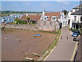
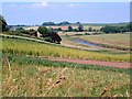
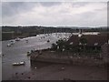
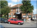
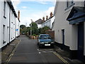
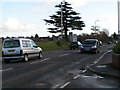
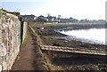
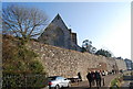
100 photos from this area
Area Information
Key information about the EX3 0EA including its size, population, and administrative classification.
- Area Type
- Postcode
- Area Size
- 3559 m²
- Population
- 1194
- Population Density
- 4474 people/km²
House Prices in EX3 0EA
17
Properties
£411,857
Average Sold Price
£103,000
Lowest Price
£900,000
Highest Price
Showing 17 properties
| Address | Type | Beds | Baths | Last Sale Price | Last Sale Date | |
|---|---|---|---|---|---|---|
| Rydon House, 20C High Street, Topsham, EX3 0EA | Terraced | 4 | 3 | £900,000 | May 2025 | |
| 17 High Street, Topsham, EX3 0EA | Terraced | 4 | 2 | £545,000 | Aug 2023 | |
| 15 High Street, Topsham, EX3 0EA | house | - | - | £260,000 | May 2019 | |
| 12 High Street, Topsham, EX3 0EA | Semi-detached | 3 | - | £385,000 | Mar 2016 | |
| 16 High Street, Topsham, EX3 0EA | Terraced | 3 | - | £370,000 | Jul 2014 | |
| 19 High Street, Topsham, EX3 0EA | Terraced | 3 | 1 | £320,000 | Dec 2013 | |
| 13 High Street, Topsham, EX3 0EA | Terraced | - | - | £103,000 | Feb 1998 | |
| 11A High Street, Topsham, EX3 0EA | Terraced | 4 | - | - | - | |
| West Country Land Surveyors, Ground Floor, Rydon House, 20C High Street, Topsham, EX3 0EA | Semi-detached | 4 | 3 | - | - | |
| 9 High Street, Topsham, EX3 0EA | retail_financial | 2 | 1 | - | - |
Page 1 of 2
Energy Efficiency in EX3 0EA
Amenities
Schools
| Rank | School | Type | Entry gender | Ages |
|---|
Explore more schools in this area
Go to Schools tabDemographics
Household Size
One person
most common
Accommodation Type
Houses
most common
Tenure
67
majority
Ethnic Group
White
most common
Religion
N/A
most common
Household Composition
N/A
most common
Age
47
median
Adults (30-64 years)
most common
Household Deprivation
N/A
with no deprivation
NS-SEC
49
in Lower managerial occupations
Explore more demographic insights in this area
Go to Demographics tabPlanning
Planning Constraints
- Flood RiskPremium
- Ramsar Wetland SitesPremium
- Area of Outstanding Natural BeautyPremium
- Protected Nature ReservePremium
- Protected WoodlandPremium