Area Overview for EX23 9NF
Photos of EX23 9NF
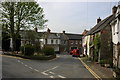
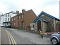
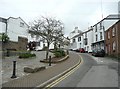
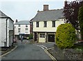
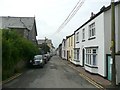
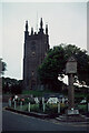

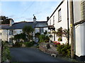
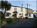
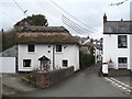
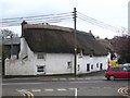

34 photos from this area
Area Information
Key information about the EX23 9NF including its size, population, and administrative classification.
- Area Type
- Postcode
- Area Size
- 41.2 hectares
- Population
- 1435
- Population Density
- 197 people/km²
House Prices in EX23 9NF
22
Properties
£380,919
Average Sold Price
£32,500
Lowest Price
£675,000
Highest Price
Showing 22 properties
| Address | Type | Beds | Baths | Last Sale Price | Last Sale Date | |
|---|---|---|---|---|---|---|
| Kernyk, Diddies Road, Stratton, Bude, EX23 9NF | Terraced | 1 | 1 | £292,500 | Mar 2025 | |
| Diddies Cottage, Diddies Road, Stratton, Bude, EX23 9NF | Semi-detached | 4 | 2 | £675,000 | Nov 2024 | |
| High Meadows, Smallridge Lane, Stratton, Bude, EX23 9NF | Detached | 5 | 4 | £599,950 | Jun 2021 | |
| Riverside, Diddies Road, Stratton, Bude, EX23 9NF | Semi-detached | 3 | 1 | £515,000 | Mar 2021 | |
| Tregon, Road From Diddies Road To Prustacott Road, Diddies, Bude, EX23 9NF | Bungalow | - | - | £305,500 | Dec 2020 | |
| Greys Folly, Diddies Road, Stratton, Bude, EX23 9NF | house | - | - | £315,000 | Oct 2020 | |
| Upfield, Smallridge Lane, Stratton, Bude, EX23 9NF | house | - | - | £510,000 | Jul 2020 | |
| Smallridge Cottage, Smallridge Lane, Stratton, Bude, EX23 9NF | house | - | - | £267,500 | Jan 2018 | |
| Strands, Smallridge Lane, Stratton, Bude, EX23 9NF | house | - | - | £530,000 | Jun 2017 | |
| Trevenen, Diddies Road, Stratton, Bude, EX23 9NF | Detached | - | - | £247,000 | May 2012 |
Page 1 of 3
Energy Efficiency in EX23 9NF
Amenities
Schools
| Rank | School | Type | Entry gender | Ages |
|---|
Explore more schools in this area
Go to Schools tabDemographics
Household Size
Two person
most common
Accommodation Type
Houses
most common
Tenure
88
majority
Ethnic Group
White
most common
Religion
N/A
most common
Household Composition
N/A
most common
Age
47
median
Elderly (65+ years)
most common
Household Deprivation
N/A
with no deprivation
NS-SEC
35
in Lower managerial occupations
Explore more demographic insights in this area
Go to Demographics tabPlanning
Planning Constraints
- Flood RiskPremium
- Ramsar Wetland SitesPremium
- Area of Outstanding Natural BeautyPremium
- Protected Nature ReservePremium
- Protected WoodlandPremium