Area Overview for EX23 8YS
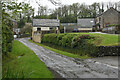
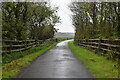
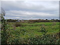
Photos of EX23 8YS
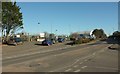

Area Information
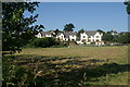
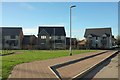
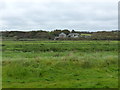
Living in EX23 8YS offers a quiet, compact residential experience in a small cluster of homes nestled in England’s countryside. With a population of 2,087, the area feels close-knit, where daily life is shaped by proximity to local amenities and natural surroundings. The community is primarily composed of adults aged 30–64, reflecting a mature demographic with established roots. Residents benefit from low flood risk and no encroachment from protected natural sites, ensuring a stable environment. The area’s appeal lies in its simplicity: a small footprint with essential services within reach. While not a hub for nightlife or major infrastructure, EX23 8YS suits those seeking a relaxed, low-maintenance lifestyle. Proximity to primary schools and basic retail ensures convenience for families, while the lack of planning constraints allows for straightforward property transactions. For buyers prioritising tranquillity over urban vibrancy, this postcode provides a self-contained world where community ties and practicality outweigh complexity.
- Area Type
- Postcode
- Area Size
- Not available
- Population
- Not available
- Population Density
- Not available
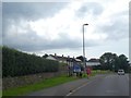
EX23 8YS is a predominantly owner-occupied area, with 51% of homes owned by residents rather than rented. The accommodation type is exclusively houses, which is unusual for a small postcode but reflects a preference for standalone properties. This suggests a market skewed towards family homes or single-occupancy residences, rather than flats or shared housing. The small size of the area means property availability is limited, and buyers should consider the immediate surroundings for more options. The absence of planning constraints, such as protected woodlands or AONB designations, simplifies development and renovation possibilities. For those seeking a house in a low-risk, stable environment, this area offers a niche market with predictable demand. However, the limited number of properties may mean competition for available homes, particularly for buyers prioritising proximity to local amenities.
House Prices in EX23 8YS
No properties found in this postcode.
Energy Efficiency in EX23 8YS
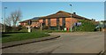
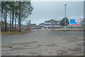
The lifestyle in EX23 8YS is defined by practicality and local convenience. Within practical reach are five retail venues, including Lidl Bude, Morrisons Bude, and Co-op Bude, providing everyday shopping needs. These stores cater to a range of budgets and preferences, ensuring residents can access essentials without traveling far. While the data does not mention dining options or parks, the presence of multiple supermarkets suggests a focus on daily living over leisure. The area’s small size means social interactions are likely to revolve around local shops and community events. For those prioritising self-sufficiency, the retail options offer a straightforward solution to household needs. The lack of detailed information on parks or recreational facilities means buyers should investigate further if outdoor space is a priority.
Amenities
Schools
Residents of EX23 8YS have access to two primary schools: Budehaven Community School and Bude Primary Academy - Juniors. Both institutions hold a ‘good’ Ofsted rating, indicating a baseline standard of education. The presence of two primary schools within the area ensures that families with young children can access schooling without long commutes. However, the absence of secondary schools in the data means parents may need to look beyond the immediate postcode for secondary education. The dual primary schools also suggest a community focus on early education, which may appeal to families prioritising school quality. With no data on pupil numbers or catchment areas, prospective buyers should verify whether the schools can accommodate growing demand.
| Rank | School | Type | Entry gender | Ages |
|---|
Explore more schools in this area
Go to Schools tabDemographics
The population of EX23 8YS skews towards adults aged 30–64, with a median age of 47. This suggests a community of settled professionals and families, rather than students or retirees. Home ownership stands at 51%, indicating a mix of owner-occupied properties and rentals. The predominant accommodation type is houses, reflecting a preference for standalone homes over flats. Ethnically, the area is predominantly White, with no data suggesting significant diversity. The absence of deprivation metrics in the data means no direct commentary on economic hardship, but the age profile implies a stable workforce and long-term residency. For buyers, this demographic suggests a mature market with properties likely to remain occupied by long-term residents. The lack of younger households or transient populations may appeal to those seeking consistency in their neighbourhood.
Household Size
Accommodation Type
Tenure
Ethnic Group
Religion
Household Composition
Age
Household Deprivation
NS-SEC
Explore more demographic insights in this area
Go to Demographics tabPlanning
Planning Constraints
- Flood RiskPremium
- Ramsar Wetland SitesPremium
- Area of Outstanding Natural BeautyPremium
- Protected Nature ReservePremium
- Protected WoodlandPremium