Area Overview for EX23 8RQ
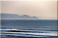
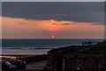
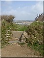
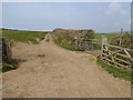
Photos of EX23 8RQ
Area Information
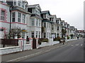
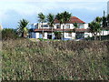
Living in EX23 8RQ means inhabiting a compact, residential postcode area in England, where 1,414 people reside across 990 square metres. The density is striking, with over 1.4 million people per square kilometre, reflecting a tightly knit community. This small cluster is characterised by a mature demographic, with a median age of 47 and a majority of residents aged 30–64. The area is predominantly home-owning, with 65% of properties owned by occupants, and housing is largely composed of individual houses. While the population is small, the area’s proximity to amenities like Sainsburys Bude and St Petroc’s School suggests a balance between residential comfort and practicality. However, the high flood risk score of 95.98 raises concerns for potential buyers, despite the low crime risk. EX23 8RQ is a place where community ties are likely strong, but environmental factors demand careful consideration.
- Area Type
- Postcode
- Area Size
- 990 m²
- Population
- Not available
- Population Density
- Not available
The property market in EX23 8RQ is dominated by owner-occupied homes, with 65% of properties owned by their residents. This contrasts with rental markets, indicating a preference for long-term investment in the area. The accommodation type is primarily houses, which may appeal to those seeking space and privacy in a compact setting. Given the area’s small size—just 990 square metres—the housing stock is limited, meaning buyers must consider nearby areas for additional options. The high home ownership rate suggests stability, but the small footprint of the postcode may limit development or diversity in property types. For buyers, this means a focus on existing homes rather than new builds, with potential competition for available properties. The market’s character is defined by its residential focus, though the flood risk assessment may influence property values and insurance costs.
House Prices in EX23 8RQ
Showing 1 properties
| Address | Type | Beds | Baths | Last Sale Price | Last Sale Date | |
|---|---|---|---|---|---|---|
| 22 Downs View, Flexbury, Bude, EX23 8RQ | Retirement | - | - | - | - |
Energy Efficiency in EX23 8RQ
Residents of EX23 8RQ have access to a range of retail amenities within practical reach, including Sainsburys Bude, Co-op Bude, and Morrisons Bude. These stores provide essential shopping options, from groceries to household items, supporting daily convenience. While the data does not mention parks, leisure facilities, or dining options, the presence of multiple retail outlets suggests a functional, community-focused environment. The compact nature of the area likely means that most amenities are within walking or short driving distance, enhancing accessibility. The mix of retail choices reflects a practical approach to living, prioritising ease of access over specialised services. For those valuing convenience, the proximity to supermarkets and local shops is a tangible benefit of residing in this postcode.
Amenities
Schools
The nearest school to EX23 8RQ is St Petroc’s School, an independent institution. While no Ofsted rating is provided, the presence of an independent school suggests a focus on private education for families in the area. Independent schools often offer tailored curricula and smaller class sizes, which may appeal to parents prioritising specific educational approaches. However, the absence of state schools in the data means families relying on public education may need to look beyond the immediate postcode. The single school listed reflects a limited choice, which could be a consideration for those requiring multiple options or specific facilities like nurseries or sixth-form provisions.
| Rank | School | Type | Entry gender | Ages |
|---|
Explore more schools in this area
Go to Schools tabDemographics
The population of EX23 8RQ is 1,414, with a median age of 47, indicating a mature, settled community. The most common age range is 30–64, suggesting a mix of established professionals and families. Home ownership is robust at 65%, with the majority of properties being houses rather than flats. The predominant ethnic group is White, though no specific data on diversity or deprivation is provided. The high population density—over 1.4 million people per square kilometre—reflects the area’s small size and concentrated living. This density may influence daily life, with limited space for expansion but potentially strong local networks. The demographic profile suggests a stable, low-turnover community, though the lack of specific data on income or deprivation means quality of life factors remain partially unexplored.
Household Size
Accommodation Type
Tenure
Ethnic Group
Religion
Household Composition
Age
Household Deprivation
NS-SEC
Explore more demographic insights in this area
Go to Demographics tabPlanning
Planning Constraints
- Flood RiskPremium
- Ramsar Wetland SitesPremium
- Area of Outstanding Natural BeautyPremium
- Protected Nature ReservePremium
- Protected WoodlandPremium