Area Overview for EX23 0YU
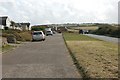
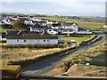
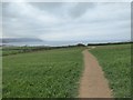
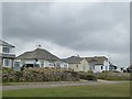
Photos of EX23 0YU


Area Information
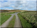
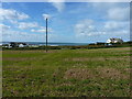
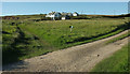
Living in EX23 0YU means being part of a small, tightly knit residential cluster in England. With a population of 2,428 spread across 44 people per square kilometre, this area offers a quiet, low-density lifestyle. The community is predominantly composed of adults aged 30–64, many of whom own their homes. Daily life here is characterised by proximity to essential services, including a range of retail outlets like Lidl, Co-op, and Morrisons, which cater to everyday needs. The area’s modest size means residents are likely to know their neighbours, fostering a sense of familiarity. While it lacks the vibrancy of larger towns, EX23 0YU provides a stable, family-oriented environment. Schools such as Marhamchurch CofE VC Primary School and Marhamchurch CofE Academy are within reach, offering education options for children. The absence of major environmental constraints or flood risks adds to its appeal for those prioritising safety and simplicity. For buyers seeking a peaceful, low-maintenance home with access to basic amenities, this postcode offers a straightforward, practical alternative to busier urban settings.
- Area Type
- Postcode
- Area Size
- Not available
- Population
- 2428
- Population Density
- 44 people/km²
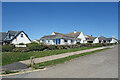
The property market in EX23 0YU is dominated by owner-occupied homes, with 75% of residents living in properties they own. This high rate of home ownership suggests a stable, long-term community with limited rental activity. The accommodation type is exclusively houses, which contrasts with areas where flats or apartments predominate. This housing stock is typical of smaller, rural or semi-rural postcode areas, where larger properties are more common. For buyers, the market offers a straightforward choice: standalone homes in a low-density setting. The small size of the area means properties are likely to be spread out, with limited scope for development. Given the absence of planning constraints or environmental restrictions, there is no indication of regulatory barriers to property transactions. However, the modest population and limited amenities may appeal more to those prioritising tranquillity over proximity to major urban centres.
House Prices in EX23 0YU
No properties found in this postcode.
Energy Efficiency in EX23 0YU
Residents of EX23 0YU have access to a modest selection of retail amenities within practical reach. Notable venues include Lidl, Co-op, and Morrisons, which collectively provide grocery and household essentials. These stores cater to daily needs, reducing the necessity for long trips to larger towns. While the data does not mention parks, leisure facilities, or dining options, the presence of multiple retail outlets suggests a focus on convenience for local residents. The area’s small size means amenities are likely to be clustered, enhancing accessibility. For those prioritising self-sufficiency, the proximity of these shops supports a lifestyle where errands can be completed without extensive travel. However, the absence of detailed information on recreational or dining options means the full breadth of lifestyle opportunities remains unexplored in this context.
Amenities
Schools
Residents of EX23 0YU have access to two schools within practical reach: Marhamchurch CofE VC Primary School, which provides early years and primary education, and Marhamchurch CofE Academy, a secondary school with an Ofsted rating of satisfactory. The presence of both a primary and secondary institution within the area offers families a cohesive educational pathway. The academy’s satisfactory rating indicates it meets baseline standards but may not excel in specialist areas such as STEM or arts. For parents, this mix of school types ensures children can remain in the same catchment area from early education through to secondary schooling. However, the absence of additional schools or independent options means families reliant on high-performing institutions may need to look beyond the immediate vicinity. The schools’ proximity to homes reduces commuting time, a practical benefit for working parents.
| Rank | School | Type | Entry gender | Ages |
|---|
Explore more schools in this area
Go to Schools tabDemographics
The demographic profile of EX23 0YU is defined by its median age of 47, with the majority of residents falling within the 30–64 age range. This suggests a mature, established community with a strong presence of middle-aged adults. Home ownership is high, at 75%, indicating that most residents are long-term occupants rather than renters. The accommodation type is predominantly houses, which aligns with the area’s low population density and suburban character. The predominant ethnic group is White, reflecting a homogenous demographic. While no specific data on deprivation is provided, the high home ownership rate and stable age distribution suggest a relatively stable economic environment. The absence of significant diversity data means the community’s cultural composition remains largely unexplored in this context. For prospective buyers, this profile signals a neighbourhood where families and individuals seeking long-term residency may find a consistent, predictable living environment.
Household Size
Accommodation Type
Tenure
Ethnic Group
Religion
Household Composition
Age
Household Deprivation
NS-SEC
Explore more demographic insights in this area
Go to Demographics tabPlanning
Planning Constraints
- Flood RiskPremium
- Ramsar Wetland SitesPremium
- Area of Outstanding Natural BeautyPremium
- Protected Nature ReservePremium
- Protected WoodlandPremium