Area Overview for EX22 6SP
Photos of EX22 6SP
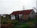
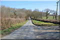


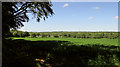
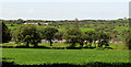

8 photos from this area
Area Information
Key information about the EX22 6SP including its size, population, and administrative classification.
- Area Type
- Postcode
- Area Size
- 72.8 hectares
- Population
- 1809
- Population Density
- 35 people/km²
House Prices in EX22 6SP
11
Properties
£323,333
Average Sold Price
£215,000
Lowest Price
£500,000
Highest Price
Showing 11 properties
| Address | Type | Beds | Baths | Last Sale Price | Last Sale Date | |
|---|---|---|---|---|---|---|
| Rosecott, Road From Judds Farm To The Old Rectory, Pyworthy, EX22 6SP | Detached | 5 | 3 | £500,000 | Jan 2023 | |
| Kinlea, Road From Judds Farm To The Old Rectory, Pyworthy, EX22 6SP | Detached | 3 | 2 | £255,000 | Sep 2015 | |
| Stonybroke, Road From Judds Farm To The Old Rectory, Pyworthy, EX22 6SP | Detached | 3 | 1 | £215,000 | May 2014 | |
| The Old Smithy, Road From Pyworthy Primary School To Judds Farm, Pyworthy, EX22 6SP | Detached | 1 | - | - | - | |
| Hoppatown, Road From Judds Farm To The Old Rectory, Pyworthy, EX22 6SP | Land | 4 | 1 | - | - | |
| Meadow View, Road From Judds Farm To The Old Rectory, Pyworthy, EX22 6SP | Cottage | 2 | 1 | - | - | |
| Recreation Ground At Grid Reference 231336 102755, Road From Pyworthy Primary School To Judds Farm, Pyworthy, EX22 6SP | Leisure | - | - | - | - | |
| 2, Lower Village, Road From Judds Farm To The Old Rectory, Pyworthy, EX22 6SP | Semi-detached | - | - | - | - | |
| 1, Lower Village, Road From Judds Farm To The Old Rectory, Pyworthy, EX22 6SP | house | - | - | - | - | |
| The Stables, Road From Judds Farm To The Old Rectory, Pyworthy, EX22 6SP | house | - | - | - | - |
Page 1 of 2
Energy Efficiency in EX22 6SP
Amenities
Schools
| Rank | School | Type | Entry gender | Ages |
|---|
Explore more schools in this area
Go to Schools tabDemographics
Household Size
Two person
most common
Accommodation Type
Houses
most common
Tenure
78
majority
Ethnic Group
White
most common
Religion
N/A
most common
Household Composition
N/A
most common
Age
47
median
Adults (30-64 years)
most common
Household Deprivation
N/A
with no deprivation
NS-SEC
27
in Lower managerial occupations
Explore more demographic insights in this area
Go to Demographics tabPlanning
Planning Constraints
- Flood RiskPremium
- Ramsar Wetland SitesPremium
- Area of Outstanding Natural BeautyPremium
- Protected Nature ReservePremium
- Protected WoodlandPremium