Area Overview for EX22 6DX
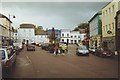
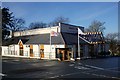
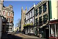
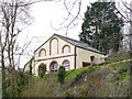
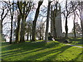
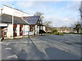
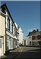
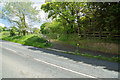
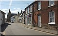
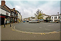
Photos of EX22 6DX


Area Information
Living in EX22 6DX offers a quiet, low-density lifestyle in a small residential cluster. With a population of 2,517 spread across 305 square metres, the area maintains a sparse, almost rural character. The population density of 49 people per square kilometre suggests a community where homes are spaced apart, fostering a sense of privacy. The median age of 47 indicates a stable population, with the majority of residents falling within the 30-64 age range. This suggests a mix of established families and older adults, creating a settled, mature neighbourhood. Daily life is supported by nearby amenities, including retail stores like Co-op Holsworthy and Morrisons Daily, as well as Sutcombe Community Primary School. The area’s small size means it is likely surrounded by open spaces or smaller villages, though specific details about nearby parks or natural features are not provided. For those seeking a peaceful, low-traffic environment with access to essential services, EX22 6DX could be an appealing choice.
- Area Type
- Postcode
- Area Size
- 305 m²
- Population
- 2517
- Population Density
- 49 people/km²
The property market in EX22 6DX is characterised by a high rate of home ownership (67%) and a focus on houses rather than flats or apartments. This suggests a community where property is typically owned rather than rented, and where housing stock is limited to individual homes. The small area size and low population density imply that the number of available properties is restricted, potentially making the market competitive for buyers. Given the prevalence of houses, the area may appeal to families or individuals seeking larger, more private living spaces. However, the limited scale of the area means that buyers may need to consider nearby regions for additional options. The lack of rental properties also indicates that the market is not geared towards short-term or transient occupancy, reinforcing the area’s stability as a long-term residential choice.
House Prices in EX22 6DX
No properties found in this postcode.
Energy Efficiency in EX22 6DX
Residents of EX22 6DX have access to a modest selection of retail amenities within practical reach, including Co-op Holsworthy, Morrisons Daily, and Waitrose Holsworthy. These stores provide essential shopping options, from groceries to household items, supporting a convenient lifestyle. The presence of multiple retail outlets suggests that daily errands can be completed locally, reducing the need for long commutes. While no parks, leisure facilities, or dining options are listed in the data, the availability of nearby shops implies a functional, community-focused environment. The area’s character is likely defined by its quiet, residential nature, with amenities prioritising practicality over luxury.
Amenities
Schools
The nearest school to EX22 6DX is Sutcombe Community Primary School, a primary-level institution. No Ofsted rating or specific performance data is provided in the available information, so the quality of education cannot be assessed here. The presence of a primary school suggests that the area is suitable for families with young children, though secondary education options are not listed. Residents may need to look to nearby villages or towns for secondary schools. The single school listed indicates a limited range of educational facilities within the immediate vicinity, which could be a consideration for families requiring a broader selection of schools.
| Rank | School | Type | Entry gender | Ages |
|---|
Explore more schools in this area
Go to Schools tabDemographics
The community in EX22 6DX is predominantly composed of adults aged 30-64, with a median age of 47. This suggests a population that is largely in their prime working years, though the area also includes older residents. Home ownership is high at 67%, indicating a stable, long-term resident base. The accommodation type is primarily houses, which aligns with the low population density and the character of a small residential cluster. The predominant ethnic group is White, though no data is provided on the presence of other ethnicities or diversity levels. The absence of specific information on deprivation or income levels means the area’s economic profile remains unclear, but the high home ownership rate and mature age demographic suggest a relatively secure financial environment for residents.
Household Size
Accommodation Type
Tenure
Ethnic Group
Religion
Household Composition
Age
Household Deprivation
NS-SEC
Explore more demographic insights in this area
Go to Demographics tabPlanning
Planning Constraints
- Flood RiskPremium
- Ramsar Wetland SitesPremium
- Area of Outstanding Natural BeautyPremium
- Protected Nature ReservePremium
- Protected WoodlandPremium