Area Overview for EX21 5DY
Photos of EX21 5DY
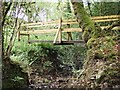
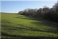
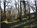
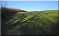
6 photos from this area
Area Information
Key information about the EX21 5DY including its size, population, and administrative classification.
- Area Type
- Postcode
- Area Size
- 67.3 hectares
- Population
- 1768
- Population Density
- 31 people/km²
House Prices in EX21 5DY
13
Properties
£235,000
Average Sold Price
£105,000
Lowest Price
£420,000
Highest Price
Showing 13 properties
| Address | Type | Beds | Baths | Last Sale Price | Last Sale Date | |
|---|---|---|---|---|---|---|
| Dunsford, Road From Tower Hill House To Dubbs Cross, Virginstow, EX21 5DY | Bungalow | - | - | £420,000 | Mar 2024 | |
| St Marys Chapel Studio, Road From Tower Hill House To Dubbs Cross, Virginstow, EX21 5DY | house | - | - | £205,000 | Mar 2022 | |
| Homlea, Road From Tower Hill House To Dubbs Cross, Virginstow, EX21 5DY | house | - | - | £105,000 | Mar 2021 | |
| Woodcot, Road From Tower Hill House To Dubbs Cross, Virginstow, EX21 5DY | Detached | 3 | 2 | £380,000 | Dec 2020 | |
| 3, Dubbs Cross, Road From Tower Hill House To Dubbs Cross, Virginstow, EX21 5DY | Bungalow | 2 | 1 | £150,000 | Jun 2018 | |
| Aldermaston House, Road From Tower Hill House To Dubbs Cross, Virginstow, EX21 5DY | Terraced | - | - | £150,000 | Nov 2004 | |
| Site Of Mobile Home, St Marys Chapel Studio, Lane To Tillislow, Virginstow, EX21 5DY | Mobile Home | - | - | - | - | |
| Tilleslow Black Barn, Lane To Tillislow, Virginstow, EX21 5DY | house | - | - | - | - | |
| Tilleslow Barn, Lane To Tillislow, Virginstow, EX21 5DY | hotel | - | - | - | - | |
| The Old Shippon, Lane To Tillislow, Virginstow, EX21 5DY | hotel | - | - | - | - |
Page 1 of 2
Energy Efficiency in EX21 5DY
Amenities
Schools
| Rank | School | Type | Entry gender | Ages |
|---|
Explore more schools in this area
Go to Schools tabDemographics
Household Size
Two person
most common
Accommodation Type
Houses
most common
Tenure
78
majority
Ethnic Group
White
most common
Religion
N/A
most common
Household Composition
N/A
most common
Age
47
median
Adults (30-64 years)
most common
Household Deprivation
N/A
with no deprivation
NS-SEC
27
in Lower managerial occupations
Explore more demographic insights in this area
Go to Demographics tabPlanning
Planning Constraints
- Flood RiskPremium
- Ramsar Wetland SitesPremium
- Area of Outstanding Natural BeautyPremium
- Protected Nature ReservePremium
- Protected WoodlandPremium