Area Overview for EX20 3SL
Photos of EX20 3SL
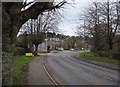
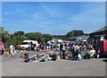


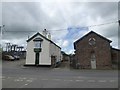
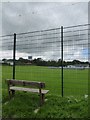
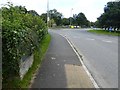
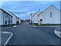
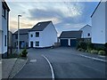
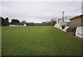
23 photos from this area
Area Information
Key information about the EX20 3SL including its size, population, and administrative classification.
- Area Type
- Postcode
- Area Size
- 4.3 hectares
- Population
- 2447
- Population Density
- 44 people/km²
House Prices in EX20 3SL
41
Properties
£122,339
Average Sold Price
£55,792
Lowest Price
£230,000
Highest Price
Showing 41 properties
| Address | Type | Beds | Baths | Last Sale Price | Last Sale Date | |
|---|---|---|---|---|---|---|
| 11 Oldham Road, Hatherleigh, EX20 3SL | Terraced | 2 | 2 | £195,000 | Jun 2023 | |
| 12 Oldham Road, Hatherleigh, EX20 3SL | house | - | - | £185,000 | Sep 2021 | |
| 1 Oldham Road, Hatherleigh, EX20 3SL | Semi-detached | 3 | 1 | £171,000 | Jun 2020 | |
| 42 Oldham Road, Hatherleigh, EX20 3SL | Semi-detached | 3 | 2 | £185,000 | Jan 2020 | |
| 2 Oldham Road, Hatherleigh, EX20 3SL | Semi-detached | 3 | 1 | £177,000 | Dec 2019 | |
| 30 Oldham Road, Hatherleigh, EX20 3SL | Terraced | 3 | 2 | £173,000 | Sep 2014 | |
| 7 Oldham Road, Hatherleigh, EX20 3SL | Terraced | 3 | 1 | £148,000 | Jun 2013 | |
| 31 Oldham Road, Hatherleigh, EX20 3SL | Detached | 4 | - | £230,000 | Jul 2012 | |
| 8 Oldham Road, Hatherleigh, EX20 3SL | house | 2 | - | £135,000 | Sep 2011 | |
| 9 Oldham Road, Hatherleigh, EX20 3SL | house | 2 | - | £124,950 | Sep 2010 |
Page 1 of 5
Energy Efficiency in EX20 3SL
Amenities
Schools
| Rank | School | Type | Entry gender | Ages |
|---|
Explore more schools in this area
Go to Schools tabDemographics
Household Size
Two person
most common
Accommodation Type
Houses
most common
Tenure
66
majority
Ethnic Group
White
most common
Religion
N/A
most common
Household Composition
N/A
most common
Age
47
median
Adults (30-64 years)
most common
Household Deprivation
N/A
with no deprivation
NS-SEC
27
in Lower managerial occupations
Explore more demographic insights in this area
Go to Demographics tabPlanning
Planning Constraints
- Flood RiskPremium
- Ramsar Wetland SitesPremium
- Area of Outstanding Natural BeautyPremium
- Protected Nature ReservePremium
- Protected WoodlandPremium