Area Overview for EX20 2NR
Photos of EX20 2NR


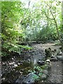
38 photos from this area
Area Information
Key information about the EX20 2NR including its size, population, and administrative classification.
- Area Type
- Postcode
- Area Size
- 9.6 hectares
- Population
- 1681
- Population Density
- 38 people/km²
House Prices in EX20 2NR
14
Properties
£407,000
Average Sold Price
£88,000
Lowest Price
£1,025,000
Highest Price
Showing 14 properties
| Address | Type | Beds | Baths | Last Sale Price | Last Sale Date | |
|---|---|---|---|---|---|---|
| Surgery Cottage, Road Past Taw River Inn, Sticklepath, EX20 2NR | house | - | - | £385,000 | Oct 2022 | |
| Trafalgar Lodge, Road Past Taw River Inn, Sticklepath, EX20 2NR | house | - | - | £1,025,000 | Nov 2020 | |
| Bridge Cottage, Road Past Taw River Inn, Sticklepath, EX20 2NR | Semi-detached | 2 | 1 | £218,000 | Nov 2020 | |
| Tawside House, Road Past Taw River Inn, Sticklepath, EX20 2NR | Detached | 7 | 3 | £725,000 | Nov 2019 | |
| Copse, Road Past Taw River Inn, Sticklepath, EX20 2NR | Detached | 3 | 3 | £200,000 | Jun 2018 | |
| Wayside, Road Past Taw River Inn, Sticklepath, EX20 2NR | house | - | - | £310,000 | Jul 2015 | |
| Bridge House, Road Past Taw River Inn, Sticklepath, EX20 2NR | house | 4 | - | £305,000 | Sep 2014 | |
| The Old Coach House, Road Past Taw River Inn, Sticklepath, EX20 2NR | Detached | - | - | £88,000 | Aug 1997 | |
| Hopedene, Road Past Taw River Inn, Sticklepath, EX20 2NR | Detached | 3 | - | - | - | |
| Lavender Cottage, Trafalgar Lodge, Road Past Taw River Inn, Sticklepath, EX20 2NR | Terraced | - | - | - | - |
Page 1 of 2
Energy Efficiency in EX20 2NR
Amenities
Schools
| Rank | School | Type | Entry gender | Ages |
|---|
Explore more schools in this area
Go to Schools tabDemographics
Household Size
Two person
most common
Accommodation Type
Houses
most common
Tenure
76
majority
Ethnic Group
White
most common
Religion
N/A
most common
Household Composition
N/A
most common
Age
47
median
Adults (30-64 years)
most common
Household Deprivation
N/A
with no deprivation
NS-SEC
37
in Lower managerial occupations
Explore more demographic insights in this area
Go to Demographics tabPlanning
Planning Constraints
- Flood RiskPremium
- Ramsar Wetland SitesPremium
- Area of Outstanding Natural BeautyPremium
- Protected Nature ReservePremium
- Protected WoodlandPremium