Area Overview for EX20 1DS
Photos of EX20 1DS
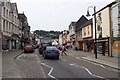
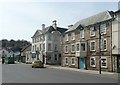
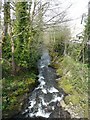

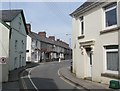
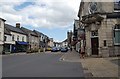

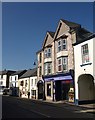


100 photos from this area
Area Information
Key information about the EX20 1DS including its size, population, and administrative classification.
- Area Type
- Postcode
- Area Size
- 9533 m²
- Population
- Not available
- Population Density
- Not available
House Prices in EX20 1DS
35
Properties
£173,190
Average Sold Price
£46,500
Lowest Price
£320,000
Highest Price
Showing 35 properties
| Address | Type | Beds | Baths | Last Sale Price | Last Sale Date | |
|---|---|---|---|---|---|---|
| 12A Kempley Road, Okehampton, EX20 1DS | Semi-detached | 2 | 1 | £175,000 | Aug 2025 | |
| 5A Kempley Road, Okehampton, EX20 1DS | Terraced | 3 | 1 | £285,000 | Sep 2024 | |
| 8 Kempley Road, Okehampton, EX20 1DS | Terraced | 2 | 2 | £170,000 | Feb 2024 | |
| 28 Kempley Road, Okehampton, EX20 1DS | Terraced | 4 | 2 | £272,500 | Jan 2024 | |
| 2 Kempley Road, Okehampton, EX20 1DS | Terraced | 2 | 2 | £175,000 | Oct 2021 | |
| 24 Kempley Road, Okehampton, EX20 1DS | Terraced | 2 | 1 | £170,000 | Aug 2021 | |
| 16 Kempley Road, Okehampton, EX20 1DS | house | - | - | £206,000 | Aug 2021 | |
| 2A Kempley Road, Okehampton, EX20 1DS | Semi-detached | 4 | 1 | £180,000 | May 2021 | |
| 22 Kempley Road, Okehampton, EX20 1DS | house | - | - | £250,000 | Jul 2019 | |
| 3 Kempley Road, Okehampton, EX20 1DS | Terraced | 4 | 2 | £205,000 | Nov 2017 |
Page 1 of 4
Energy Efficiency in EX20 1DS
Amenities
Schools
| Rank | School | Type | Entry gender | Ages |
|---|
Explore more schools in this area
Go to Schools tabDemographics
Household Size
One person
most common
Accommodation Type
Houses
most common
Tenure
56
majority
Ethnic Group
White
most common
Religion
N/A
most common
Household Composition
N/A
most common
Age
47
median
Adults (30-64 years)
most common
Household Deprivation
N/A
with no deprivation
NS-SEC
23
in Lower managerial occupations
Explore more demographic insights in this area
Go to Demographics tabPlanning
Planning Constraints
- Flood RiskPremium
- Ramsar Wetland SitesPremium
- Area of Outstanding Natural BeautyPremium
- Protected Nature ReservePremium
- Protected WoodlandPremium