Area Overview for EX2 9EW
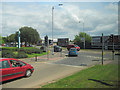
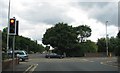
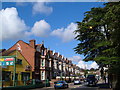
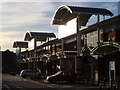
Photos of EX2 9EW


Area Information
Living in EX2 9EW means being part of a tightly knit residential cluster in England, where 1,555 people are spread across just 1.6 hectares. This compact area, with a population density of 95,746 people per square kilometre, reflects a densely populated yet focused community. Situated near Exeter, it offers proximity to urban amenities while retaining a residential character. The area is defined by its mix of houses, with 58% of residents owning their homes, suggesting a stable, long-term community. Daily life here is shaped by the surrounding infrastructure: nearby rail stations, retail hubs, and ferry access to nearby waterways. The median age of 47 indicates a mature population, with adults aged 30–64 forming the largest demographic. This suggests a community with established careers and families, likely valuing convenience and accessibility. The area’s small size means it is best suited for those prioritising proximity to services over expansive living space, with a clear emphasis on practicality over sprawling layouts.
- Area Type
- Postcode
- Area Size
- 1.6 hectares
- Population
- 1555
- Population Density
- 7578 people/km²
The property market in EX2 9EW is characterised by a strong owner-occupied sector, with 58% of homes owned by residents rather than rented. This suggests a community of long-term residents rather than transient renters, which can stabilise local property values. The accommodation type is predominantly houses, indicating a lack of flats or apartments. Given the area’s small size—just 1.6 hectares—housing stock is limited, which may make the market competitive for buyers. The high population density implies that demand for properties is concentrated, potentially driving up prices. For buyers, this means considering the immediate surroundings for additional options. The focus on owner-occupied homes also suggests a market where long-term investment is valued, with properties likely to retain their appeal due to the area’s established character and proximity to services.
House Prices in EX2 9EW
Showing 29 properties
| Address | Type | Beds | Baths | Last Sale Price | Last Sale Date | |
|---|---|---|---|---|---|---|
| 55 Queens Road, Exeter, EX2 9EW | Detached | 3 | 1 | £370,000 | Nov 2025 | |
| 82 Queens Road, Exeter, EX2 9EW | house | 4 | 1 | £638,000 | Nov 2022 | |
| 76 Queens Road, Exeter, EX2 9EW | Detached | 4 | 1 | £485,000 | Oct 2022 | |
| 70 Queens Road, Exeter, EX2 9EW | house | - | - | £510,000 | Feb 2022 | |
| 78A Queens Road, Exeter, EX2 9EW | Bungalow | - | - | £295,000 | Dec 2021 | |
| 61 Queens Road, Exeter, EX2 9EW | Semi-detached | 4 | 2 | £434,350 | May 2021 | |
| 45 Queens Road, Exeter, EX2 9EW | house | - | - | £542,500 | Apr 2021 | |
| 69 Queens Road, Exeter, EX2 9EW | Bungalow | 3 | 1 | £340,000 | Nov 2020 | |
| 59 Queens Road, Exeter, EX2 9EW | house | 3 | 2 | £325,000 | Jan 2018 | |
| 80 Queens Road, Exeter, EX2 9EW | house | 4 | - | £460,000 | Nov 2016 |
Energy Efficiency in EX2 9EW
The lifestyle in EX2 9EW is shaped by its proximity to a range of amenities. Retail options include The Southern Co-operative Co, Iceland Exeter Retail, and Aldi St, providing access to everyday essentials. The area’s rail network, with stations like Exeter St Thomas and Exeter Central, offers convenient links to Exeter’s cultural and commercial hubs. For those seeking alternative travel, three ferry landings provide access to nearby waterways and towns. The presence of Exeter International Airport adds to the area’s connectivity, supporting both leisure and business travel. While the data does not specify parks or leisure facilities, the mix of retail, transport, and ferry options suggests a practical, service-oriented lifestyle. Residents can enjoy a balance of convenience and accessibility, with amenities clustered nearby to reduce the need for long commutes. The compact nature of the area means that daily needs are met within a short distance, enhancing the overall quality of life.
Amenities
Schools
The nearest school to EX2 9EW is St Thomas Primary School, which serves the area’s primary education needs. The school is rated ‘good’ by Ofsted, indicating a reliable standard of teaching and facilities. As the only school listed in the data, it is the primary option for families in the area. The absence of secondary schools or alternative educational institutions suggests that residents may need to travel to nearby towns for higher education. However, the ‘good’ rating at St Thomas Primary School provides reassurance for parents seeking quality early education. The school’s presence also contributes to the area’s community feel, offering a focal point for local families. For those prioritising proximity to schools, EX2 9EW’s primary education options are solid, though further research would be needed for secondary schooling.
| Rank | School | Type | Entry gender | Ages |
|---|
Explore more schools in this area
Go to Schools tabDemographics
The community in EX2 9EW is predominantly composed of adults aged 30–64, with a median age of 47. This suggests a population focused on established careers and family life, with fewer young dependents or retirees. Home ownership is strong, with 58% of residents owning their properties, compared to 42% renting. The accommodation type is largely houses, reflecting a preference for private, standalone homes over flats or apartments. The predominant ethnic group is White, though specific diversity metrics are not provided. The high population density, combined with a mature age profile, indicates a stable, long-term community with limited turnover. For quality of life, this demographic may prioritise low crime rates and proximity to essential services. However, the area’s compact size and high density could influence housing availability and local amenities.
Household Size
Accommodation Type
Tenure
Ethnic Group
Religion
Household Composition
Age
Household Deprivation
NS-SEC
Explore more demographic insights in this area
Go to Demographics tabPlanning
Planning Constraints
- Flood RiskPremium
- Ramsar Wetland SitesPremium
- Area of Outstanding Natural BeautyPremium
- Protected Nature ReservePremium
- Protected WoodlandPremium