Area Overview for EX2 9DY
Photos of EX2 9DY


Area Information
Living in EX2 9DY means inhabiting a compact, densely populated residential cluster in England. The area covers 5,818 square metres and is home to 1,482 people, making it one of the most densely populated regions in the country, with 254,711 people per square kilometre. This small postcode area is defined by its proximity to essential services and transport links. Residents benefit from nearby schools, rail networks, and ferry access, which contribute to a connected lifestyle. The community is predominantly composed of adults aged 30–64, with a median age of 47, suggesting a stable, mature demographic. While the area is small, it offers a mix of housing types, with 77% of properties owned by residents rather than rented. The high population density and limited space mean the area is best suited for those prioritising convenience over expansive living spaces. Despite its size, EX2 9DY’s strategic location near Exeter International Airport and multiple railway stations positions it as a practical choice for commuters and families seeking proximity to urban amenities.
- Area Type
- Postcode
- Area Size
- 5818 m²
- Population
- 1482
- Population Density
- 2127 people/km²
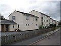
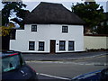
The property market in EX2 9DY is dominated by owner-occupied homes, with 77% of properties owned by residents rather than rented out. This high rate of home ownership suggests a stable, long-term community with limited turnover. The predominant accommodation type is houses, which is unusual for a small, densely populated area. This indicates a focus on single-family homes, possibly with larger gardens or private spaces, despite the compact nature of the postcode. The limited size of EX2 9DY means the housing stock is finite, which could make the area competitive for buyers. For those seeking a rental property, options may be scarce, as the market is primarily geared toward owner-occupiers. The presence of houses rather than flats or apartments may appeal to families or individuals prioritising space and privacy. However, the small area’s constraints mean buyers should consider proximity to nearby towns or cities for additional living space.
House Prices in EX2 9DY
Showing 24 properties
| Address | Type | Beds | Baths | Last Sale Price | Last Sale Date | |
|---|---|---|---|---|---|---|
| 91 Wellington Road, Exeter, EX2 9DY | Retail | 3 | 1 | £193,000 | Jun 2022 | |
| 97A Wellington Road, Exeter, EX2 9DY | Maisonette | 3 | 1 | £160,000 | Jan 2020 | |
| 89 Wellington Road, Exeter, EX2 9DY | Maisonette | 3 | 1 | £150,000 | Nov 2018 | |
| 101A Wellington Road, Exeter, EX2 9DY | Maisonette | 3 | 1 | £160,000 | Jun 2016 | |
| 95A Wellington Road, Exeter, EX2 9DY | Maisonette | 3 | 1 | £125,000 | Jan 2015 | |
| 83 Wellington Road, Exeter, EX2 9DY | Bungalow | 1 | - | £99,000 | Mar 2010 | |
| 99 Wellington Road, Exeter, EX2 9DY | Maisonette | - | - | £39,500 | Apr 1999 | |
| 95 Wellington Road, Exeter, EX2 9DY | Maisonette | 3 | 1 | - | - | |
| 73 Wellington Road, Exeter, EX2 9DY | Maisonette | 3 | - | - | - | |
| 71 Wellington Road, Exeter, EX2 9DY | Bungalow | - | - | - | - |
Energy Efficiency in EX2 9DY
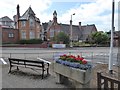
Residents of EX2 9DY have access to a range of amenities within walking or short driving distance. Retail options include Iceland Exeter Retail, The Southern Co-operative Co, and Sainsburys Alphington, providing everyday shopping needs. The area’s rail network, with stations like Exeter St Thomas and Marsh Barton, offers convenient links to Exeter’s city centre and surrounding regions. Ferry landings at Topsham Lock and Turf Lock Inn provide alternative transport for those near waterways, while Exeter International Airport is within reach for air travel. The compact nature of the area means amenities are closely clustered, reducing the need for long commutes. However, the absence of large leisure or recreational spaces within the postcode itself suggests that residents may need to travel to nearby towns for parks or entertainment. Despite this, the proximity to transport hubs and retail outlets ensures a practical, connected lifestyle.
Amenities
Schools
The nearest schools to EX2 9DY include West Exe School, which operates as both a primary school and an academy with an Ofsted rating of ‘good’. This dual designation offers families flexibility, with the primary school catering to younger children and the academy providing secondary education. The ‘good’ Ofsted rating indicates a school that meets national standards, though it is not among the top-performing institutions. The presence of a single school within the area suggests that families may need to travel to nearby towns for additional educational options. However, the proximity of West Exe School to EX2 9DY reduces commuting time for students. The mix of school types ensures a range of educational approaches, but the lack of multiple schools in the immediate vicinity may be a consideration for parents seeking competition or alternative curricula.
| Rank | School | Type | Entry gender | Ages |
|---|
Explore more schools in this area
Go to Schools tabDemographics
The population of EX2 9DY is characterised by a median age of 47, with the majority of residents falling within the 30–64 age range. This suggests a community of working-age adults, likely with established careers and families. Home ownership is high, with 77% of properties owned by residents, indicating a stable housing market and long-term residency. The predominant accommodation type is houses, reflecting a preference for single-family homes over flats or apartments. The ethnic composition is predominantly White, though specific diversity metrics are not provided. The high home ownership rate and mature age profile suggest a low turnover of residents, fostering a sense of continuity. However, the area’s small size and high density may limit opportunities for new arrivals, making it a niche market for those seeking a tightly knit, established community. The absence of detailed deprivation data means the quality of life remains unquantified, though the low crime score of 70 implies a generally safe environment.
Household Size
Accommodation Type
Tenure
Ethnic Group
Religion
Household Composition
Age
Household Deprivation
NS-SEC
Explore more demographic insights in this area
Go to Demographics tabPlanning
Planning Constraints
- Flood RiskPremium
- Ramsar Wetland SitesPremium
- Area of Outstanding Natural BeautyPremium
- Protected Nature ReservePremium
- Protected WoodlandPremium