Area Overview for EX2 9BW
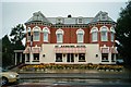
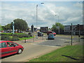
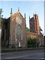
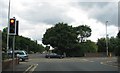
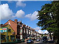
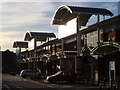
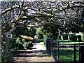
Photos of EX2 9BW


Area Information
Living in EX2 9BW means inhabiting a tightly packed residential cluster in England, where 1,626 people reside across just 9,697 square metres. The area’s density is striking — over 167,000 people per square kilometre — creating a compact, intimate community. This is a place where daily life revolves around close proximity to amenities, with residents likely to walk or cycle to nearby shops, transport hubs, and schools. The area’s small size means it is not sprawling but intensely utilised, with homes predominantly as houses rather than flats. The demographic profile suggests a mature population, with a median age of 47 and most residents in the 30-64 age bracket. This hints at a community of established families and professionals, many of whom own their homes. The area’s proximity to Exeter’s transport networks and retail centres adds to its appeal, though its high density may mean limited green space. For those seeking a compact, well-connected living environment, EX2 9BW offers a blend of convenience and proximity, albeit with a need to consider its environmental constraints.
- Area Type
- Postcode
- Area Size
- 9697 m²
- Population
- 1626
- Population Density
- 9582 people/km²
The property market in EX2 9BW is characterised by high home ownership, with 68% of residents living in owner-occupied homes. This suggests a community of long-term residents rather than a transient rental market. The accommodation type is predominantly houses, which is notable in a high-density area, potentially indicating older or larger properties. Given the area’s small size and compact layout, the housing stock is limited, which may mean that properties are in high demand. Buyers should consider the proximity to amenities and transport networks as key selling points, though the area’s environmental constraints — such as flood risk — could impact property values. The focus on owner-occupation suggests that the market is not driven by renters, making it a potentially stable but niche area for buyers seeking a compact, well-connected home.
House Prices in EX2 9BW
Showing 50 properties
| Address | Type | Beds | Baths | Last Sale Price | Last Sale Date | |
|---|---|---|---|---|---|---|
| 13 Ferndale Road, Exeter, EX2 9BW | Terraced | 3 | 1 | £270,000 | Mar 2025 | |
| 5 Ferndale Road, Exeter, EX2 9BW | Terraced | 3 | 1 | £313,000 | Dec 2022 | |
| 30 Ferndale Road, Exeter, EX2 9BW | Retail | 3 | 1 | £254,000 | Nov 2022 | |
| 14 Ferndale Road, Exeter, EX2 9BW | Terraced | 2 | 1 | £239,000 | Jul 2021 | |
| 31 Ferndale Road, Exeter, EX2 9BW | Terraced | - | - | £15,500 | Jun 2021 | |
| 21 Ferndale Road, Exeter, EX2 9BW | house | 3 | - | £295,000 | Nov 2020 | |
| 34 Ferndale Road, Exeter, EX2 9BW | house | 2 | - | £209,950 | Oct 2019 | |
| 10 Ferndale Road, Exeter, EX2 9BW | Terraced | 2 | 1 | £233,000 | Sep 2019 | |
| 8 Ferndale Road, Exeter, EX2 9BW | Terraced | 2 | 1 | £220,000 | Aug 2019 | |
| 15 Ferndale Road, Exeter, EX2 9BW | house | - | - | £220,750 | Feb 2019 |
Energy Efficiency in EX2 9BW
Life in EX2 9BW is shaped by its proximity to a range of amenities. Within reach are five retail venues, including Tesco Exeter, Co-op Exeter, and Aldi St, providing everyday shopping needs. The area’s rail network is extensive, with five stations offering connections to Exeter’s city centre and beyond. Ferry landings such as Topsham Lock and Turf Lock Inn add alternative transport options, particularly for those near waterways. The presence of Exeter International Airport ensures easy access to regional and international travel. While the data does not mention parks or leisure facilities, the high density of retail and transport hubs suggests a lifestyle focused on convenience and connectivity. Residents can access daily essentials, travel efficiently, and utilise the airport for broader mobility, though the area’s compact size may limit opportunities for open-space recreation.
Amenities
Schools
The schools nearest to EX2 9BW include Cowick First School, a primary school, and West Exe Nursery School, which provides early education. These institutions cater to young families, offering essential educational services for children aged 3–11. The presence of a primary school and nursery suggests that the area is suitable for families with young children, though no data on Ofsted ratings or academic performance is available. The limited range of school types — only primary and nursery — may require parents to travel further for secondary education. However, the proximity of these schools to residential properties indicates that the area is designed to support family living, with education within practical reach. For those prioritising immediate access to schools, EX2 9BW offers a basic but functional educational infrastructure.
| Rank | School | Type | Entry gender | Ages |
|---|
Explore more schools in this area
Go to Schools tabDemographics
The community in EX2 9BW is defined by its age profile, with a median age of 47 and the majority of residents aged 30-64. This suggests a population of working-age adults and families with children, though the data does not specify the proportion of children or retirees. Home ownership is high, with 68% of residents living in owner-occupied properties, indicating a stable, long-term demographic. The accommodation type is predominantly houses, which is unusual for a high-density area but may reflect older housing stock or specific planning. The predominant ethnic group is White, though no data on diversity or minority representation is provided. The high population density — over 167,000 people per square kilometre — implies a mix of households in a limited space, which may influence community dynamics. While the data does not quantify deprivation or income levels, the combination of high home ownership and a mature age group suggests a relatively stable socioeconomic profile.
Household Size
Accommodation Type
Tenure
Ethnic Group
Religion
Household Composition
Age
Household Deprivation
NS-SEC
Explore more demographic insights in this area
Go to Demographics tabPlanning
Planning Constraints
- Flood RiskPremium
- Ramsar Wetland SitesPremium
- Area of Outstanding Natural BeautyPremium
- Protected Nature ReservePremium
- Protected WoodlandPremium