Area Overview for EX2 8XD
Photos of EX2 8XD


Area Information
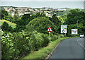
Living in EX2 8XD offers a compact, residential experience within a small cluster of homes. The area covers 2,235 square metres and is home to 1,221 residents, creating a densely populated yet manageable community. With a population density of 538 people per square kilometre, the area feels close-knit, though not overwhelming. The postcode is positioned near practical transport links, including multiple railway stations and ferry landings, which make commuting to nearby towns like Exeter or Topsham straightforward. Daily life here is shaped by its proximity to retail hubs such as Lidl Marsh and Sainsburys Alphington, ensuring everyday needs are met locally. The area’s small size means it’s unlikely to have sprawling developments, but it does offer a quiet, residential character. For those seeking a balance between convenience and tranquillity, EX2 8XD provides access to both local amenities and regional connectivity. The presence of Exeter International Airport nearby adds to its appeal for those requiring frequent travel. This is a place where practicality meets simplicity, ideal for those prioritising accessibility without sacrificing a sense of community.
- Area Type
- Postcode
- Area Size
- 2235 m²
- Population
- 1221
- Population Density
- 538 people/km²
The property market in EX2 8XD is characterised by a high rate of home ownership, with 73% of residents owning their homes. This suggests a strong preference for long-term residency rather than rental properties, which are less prevalent in the area. The predominant accommodation type is houses, indicating a mix of semi-detached and detached properties typical of smaller residential clusters. Given the area’s compact size, the housing stock is likely limited to a few hundred properties, making it a niche market. Buyers should consider that the area is not a large estate but a tightly defined postcode, which may mean fewer options for those seeking a wide range of properties. However, the presence of nearby amenities and transport links could enhance the appeal of homes here. For those prioritising ownership over rental flexibility, EX2 8XD offers a stable, mature market with established properties.
House Prices in EX2 8XD
Showing 7 properties
| Address | Type | Beds | Baths | Last Sale Price | Last Sale Date | |
|---|---|---|---|---|---|---|
| 28 Willsdown Road, Exeter, EX2 8XD | house | - | - | £290,000 | Oct 2021 | |
| 18 Willsdown Road, Exeter, EX2 8XD | Semi-detached | 3 | 1 | £235,500 | Aug 2016 | |
| 24 Willsdown Road, Exeter, EX2 8XD | house | - | - | £141,000 | Aug 2002 | |
| 16 Willsdown Road, Exeter, EX2 8XD | Detached | 4 | 2 | - | - | |
| 20 Willsdown Road, Exeter, EX2 8XD | Semi-detached | 4 | 2 | - | - | |
| 22 Willsdown Road, Exeter, EX2 8XD | Semi-detached | - | - | - | - | |
| 26 Willsdown Road, Exeter, EX2 8XD | Semi-detached | - | - | - | - |
Energy Efficiency in EX2 8XD
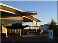
Residents of EX2 8XD have access to a range of practical amenities within walking or short driving distance. The retail sector includes supermarkets like Lidl Marsh, Spar, and Sainsburys Alphington, ensuring everyday shopping needs are met locally. The area’s railway stations—such as Marsh Barton and Exeter St Thomas—provide easy access to Exeter’s city centre, where more extensive shopping, dining, and cultural options are available. Ferry landings like Topsham Lock and Turf Lock Inn offer scenic routes to nearby towns, adding to the area’s charm. The presence of Exeter International Airport nearby is a significant advantage for those requiring regular air travel. While the area itself is small, its strategic location ensures residents can enjoy both local convenience and regional connectivity. The mix of retail, transport, and travel options creates a lifestyle that balances simplicity with accessibility.
Amenities
Schools
| Rank | School | Type | Entry gender | Ages |
|---|
Explore more schools in this area
Go to Schools tabDemographics
The community in EX2 8XD is predominantly composed of adults aged 30–64, with a median age of 47. This suggests a mature, stable population, likely with established careers and families. Home ownership is high, with 73% of residents owning their homes, indicating a long-term commitment to the area. The primary accommodation type is houses, reflecting a more traditional, settled demographic. The predominant ethnic group is White, which aligns with broader regional trends. The population density of 538 people per square kilometre means the area is neither sparse nor overcrowded, contributing to a manageable living environment. While no specific data on deprivation is provided, the high home ownership rate and age profile suggest a community with relatively stable economic conditions. This demographic profile implies a focus on quality of life, with residents likely prioritising stability and proximity to essential services.
Household Size
Accommodation Type
Tenure
Ethnic Group
Religion
Household Composition
Age
Household Deprivation
NS-SEC
Explore more demographic insights in this area
Go to Demographics tabPlanning
Planning Constraints
- Flood RiskPremium
- Ramsar Wetland SitesPremium
- Area of Outstanding Natural BeautyPremium
- Protected Nature ReservePremium
- Protected WoodlandPremium