Area Overview for EX2 8US
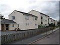
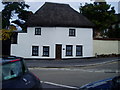
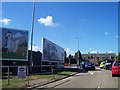
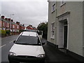
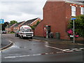
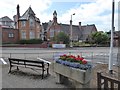
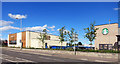
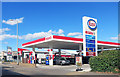
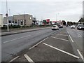
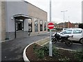
Photos of EX2 8US


Area Information
Living in EX2 8US offers a compact, residential experience within a small cluster of homes in England. Covering 9,787 square metres, this area is densely populated, with 1,278 residents spread across 1,026 people per square kilometre. Its proximity to Exeter and surrounding towns makes it a practical choice for commuters, while its small size fosters a tight-knit community feel. Daily life here is shaped by its accessibility to key services, including retail outlets like Sainsburys Alphington and multiple railway stations. The area’s low population density suggests a mix of family homes and single-occupancy properties, though the exact balance isn’t specified. With no major environmental constraints or flood risks, it presents a stable environment for long-term living. Residents benefit from nearby transport links, including three ferry landings and access to Exeter International Airport, which enhances connectivity for both leisure and business travel. The area’s character is defined by its practicality, with amenities within walking or short driving distance, making it appealing to those prioritising convenience over sprawling landscapes.
- Area Type
- Postcode
- Area Size
- 9787 m²
- Population
- 1278
- Population Density
- 1026 people/km²
The property market in EX2 8US is characterised by a high rate of home ownership (69%) and a predominance of houses over flats or apartments. This suggests a market skewed towards owner-occupied properties, likely attracting families or individuals seeking stable, long-term housing. The absence of rental data means the extent of the rental market is unclear, but the focus on houses implies limited availability of smaller, more transient properties. Given the area’s small size and dense population, properties are likely in high demand, with limited scope for expansion. Buyers should consider the practicality of the housing stock—houses may offer more space than needed for single occupants but align with the needs of families. The lack of planning constraints or environmental restrictions further supports the appeal of EX2 8US as a reliable investment, though the small size of the area means competition for properties could be fierce.
House Prices in EX2 8US
Showing 7 properties
| Address | Type | Beds | Baths | Last Sale Price | Last Sale Date | |
|---|---|---|---|---|---|---|
| 1 Bate Close, Exeter, EX2 8US | house | - | - | £400,000 | Sep 2018 | |
| 4 Bate Close, Exeter, EX2 8US | Detached | 4 | - | £328,000 | Aug 2015 | |
| 2 Bate Close, Exeter, EX2 8US | Detached | 4 | 2 | £328,000 | Aug 2015 | |
| 5 Bate Close, Exeter, EX2 8US | Detached | 4 | 2 | £290,000 | Aug 2009 | |
| 6 Bate Close, Exeter, EX2 8US | Detached | 4 | 2 | £285,000 | Sep 2008 | |
| 7 Bate Close, Exeter, EX2 8US | Detached | 4 | 2 | £183,950 | Jul 2002 | |
| 3 Bate Close, Exeter, EX2 8US | house | 4 | - | £187,950 | Apr 2002 |
Energy Efficiency in EX2 8US
The lifestyle in EX2 8US is shaped by its proximity to essential amenities. Retail options include Spar, Lidl Marsh, and Sainsburys Alphington, providing everyday shopping convenience. The area’s rail network, with stations such as Marsh Barton and Exeter St Thomas, facilitates easy commuting to Exeter’s city centre and beyond. For those near water, three ferry landings offer alternative transport, particularly useful for local travel along the river. The presence of Exeter International Airport adds to the area’s appeal for frequent travellers. While there is no mention of parks or leisure facilities in the data, the density of retail and transport options suggests a practical, service-oriented lifestyle. Residents can access both local essentials and regional hubs without long commutes, blending convenience with the potential for a quieter, residential environment.
Amenities
Schools
| Rank | School | Type | Entry gender | Ages |
|---|
Explore more schools in this area
Go to Schools tabDemographics
The community in EX2 8US is predominantly composed of adults aged 30–64, with a median age of 47. This suggests a mature, established population, likely with strong ties to local institutions and a focus on stability. Home ownership is high at 69%, indicating a preference for long-term residency over rental properties. The area’s accommodation is primarily houses, which aligns with the demographic profile of older, family-oriented residents. Ethnically, the population is predominantly White, though no further breakdown of diversity is provided. The absence of specific data on deprivation means the area’s quality of life cannot be assessed in terms of socioeconomic challenges, but the high home ownership rate and low crime risk suggest a relatively secure, self-sufficient community. With no protected natural areas or planning constraints, residents enjoy a straightforward living environment without regulatory complications.
Household Size
Accommodation Type
Tenure
Ethnic Group
Religion
Household Composition
Age
Household Deprivation
NS-SEC
Explore more demographic insights in this area
Go to Demographics tabPlanning
Planning Constraints
- Flood RiskPremium
- Ramsar Wetland SitesPremium
- Area of Outstanding Natural BeautyPremium
- Protected Nature ReservePremium
- Protected WoodlandPremium