Area Overview for EX2 8UP
Photos of EX2 8UP
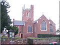


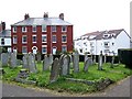
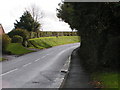


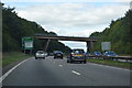
61 photos from this area
Area Information
Key information about the EX2 8UP including its size, population, and administrative classification.
- Area Type
- Postcode
- Area Size
- 1.4 hectares
- Population
- 1472
- Population Density
- 2254 people/km²
House Prices in EX2 8UP
20
Properties
£268,600
Average Sold Price
£180,000
Lowest Price
£451,550
Highest Price
Showing 20 properties
| Address | Type | Beds | Baths | Last Sale Price | Last Sale Date | |
|---|---|---|---|---|---|---|
| 4A Ide Lane, Alphington, Exeter, EX2 8UP | Semi-detached | 2 | 1 | £260,000 | Oct 2024 | |
| 6 Ide Lane, Alphington, Exeter, EX2 8UP | house | - | - | £451,550 | Dec 2020 | |
| 8 Ide Lane, Alphington, Exeter, EX2 8UP | Detached | 3 | 1 | £342,000 | Dec 2018 | |
| 14 Ide Lane, Alphington, Exeter, EX2 8UP | house | - | - | £322,000 | Dec 2017 | |
| 4B Ide Lane, Alphington, Exeter, EX2 8UP | house | - | - | £242,000 | Nov 2012 | |
| 14A Ide Lane, Alphington, Exeter, EX2 8UP | Semi-detached | - | - | £211,000 | Dec 2007 | |
| 2A Ide Lane, Alphington, Exeter, EX2 8UP | Semi-detached | - | - | £194,950 | Jul 2006 | |
| 25 IDE LANE, Alphington, Exeter, EX2 8UP | Detached | - | - | £300,000 | Oct 2005 | |
| 4 Ide Lane, Alphington, Exeter, EX2 8UP | Terraced | 2 | - | £182,500 | Feb 2005 | |
| 2 Ide Lane, Alphington, Exeter, EX2 8UP | Detached | - | - | £180,000 | Jul 2003 |
Page 1 of 2
Energy Efficiency in EX2 8UP
Amenities
Schools
| Rank | School | Type | Entry gender | Ages |
|---|
Explore more schools in this area
Go to Schools tabDemographics
Household Size
Two person
most common
Accommodation Type
Houses
most common
Tenure
71
majority
Ethnic Group
White
most common
Religion
N/A
most common
Household Composition
N/A
most common
Age
47
median
Adults (30-64 years)
most common
Household Deprivation
N/A
with no deprivation
NS-SEC
36
in Lower managerial occupations
Explore more demographic insights in this area
Go to Demographics tabPlanning
Planning Constraints
- Flood RiskPremium
- Ramsar Wetland SitesPremium
- Area of Outstanding Natural BeautyPremium
- Protected Nature ReservePremium
- Protected WoodlandPremium