Area Overview for EX2 8SH
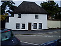
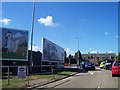
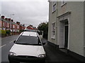
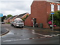
Photos of EX2 8SH


Area Information
Living in EX2 8SH offers a compact, tightly knit residential experience. The area covers 4,904 square metres and is home to 1,278 residents, creating a dense but manageable community. With a population density of 1,026 people per square kilometre, it’s a small cluster of homes that balances proximity with space. The area’s character is defined by its mix of practicality and accessibility, with nearby rail stations and ferry landings ensuring easy travel. Daily life here is shaped by its demographics: a mature population with a median age of 47, predominantly adults aged 30–64. This suggests a community rooted in stability, with many residents likely to be long-term homeowners. The area’s proximity to Exeter International Airport and multiple railway stations, combined with local shops like Sainsburys Alphington and Lidl Marsh, means essentials are within reach. However, the high flood risk score of 100 is a critical consideration for prospective buyers, requiring careful evaluation of property resilience and insurance options.
- Area Type
- Postcode
- Area Size
- 4904 m²
- Population
- 1278
- Population Density
- 1026 people/km²
The property market in EX2 8SH is characterised by a high rate of home ownership, with 69% of properties owned by residents rather than rented. This suggests a stable, long-term market where homeownership is the norm. The accommodation type is predominantly houses, which contrasts with areas dominated by flats or apartments. This housing stock may appeal to families or those seeking more space, but the small area size means the number of available properties is limited. Buyers should consider that the market is likely competitive, with few options for rental properties. The concentration of houses also implies that properties may be larger or more traditional in design. Given the area’s compact nature, prospective buyers should investigate nearby areas for additional options, though the immediate surroundings may offer similar characteristics.
House Prices in EX2 8SH
Showing 15 properties
| Address | Type | Beds | Baths | Last Sale Price | Last Sale Date | |
|---|---|---|---|---|---|---|
| 27 Church Road, Alphington, Exeter, EX2 8SH | Terraced | 2 | 1 | £285,000 | Oct 2023 | |
| 17 Church Road, Alphington, Exeter, EX2 8SH | Retail | 3 | 2 | £332,000 | Aug 2022 | |
| 20 Church Road, Alphington, Exeter, EX2 8SH | Terraced | 3 | 1 | £127,000 | Nov 2017 | |
| 21 Church Road, Alphington, Exeter, EX2 8SH | Terraced | 3 | - | £230,000 | Feb 2015 | |
| 18 Church Road, Alphington, Exeter, EX2 8SH | house | - | - | £155,000 | Jan 2012 | |
| 19 Church Road, Alphington, Exeter, EX2 8SH | house | - | - | £165,000 | Jun 2009 | |
| 14 Church Road, Alphington, Exeter, EX2 8SH | Semi-detached | - | - | £152,000 | May 2009 | |
| 33 Church Road, Alphington, Exeter, EX2 8SH | Terraced | - | - | £58,950 | May 1998 | |
| 16 Church Road, Alphington, Exeter, EX2 8SH | house | - | - | £47,000 | Jan 1996 | |
| 25 Church Road, Alphington, Exeter, EX2 8SH | house | - | - | - | - |
Energy Efficiency in EX2 8SH
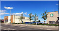
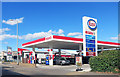
Residents of EX2 8SH have access to a range of local amenities within practical reach. The retail options include Sainsburys Alphington, Lidl Marsh, and Spar, ensuring everyday shopping needs are met without long journeys. The area’s proximity to multiple railway stations, such as Exeter St Thomas and Exeter Central, provides easy access to urban centres, while ferry landings like Topsham Ferry Landing connect to nearby waterways. Exeter International Airport is also nearby, adding to the area’s transport versatility. The presence of these amenities supports a convenient lifestyle, with a balance between local convenience and broader connectivity. The mix of retail, transport, and travel options means residents can enjoy both independent living and the flexibility to travel. However, the area’s small size means the variety of leisure or cultural facilities is limited, requiring trips to larger towns for more extensive options.
Amenities
Schools
| Rank | School | Type | Entry gender | Ages |
|---|
Explore more schools in this area
Go to Schools tabDemographics
The community in EX2 8SH is predominantly composed of adults aged 30–64, with a median age of 47. This indicates a mature population, likely with established careers and family structures. Home ownership is high, with 69% of properties owner-occupied, suggesting a stable housing market and long-term residency. The area is primarily composed of houses rather than flats, reflecting a traditional, family-friendly layout. The predominant ethnic group is White, with no specific data on other demographics provided. The population density of 1,026 people per square kilometre implies a close-knit environment, though the small area size means the community is tightly concentrated. This density, combined with the age profile, suggests a focus on practical living rather than transient or student populations. The absence of significant diversity data means the community’s social fabric is largely defined by its core demographic.
Household Size
Accommodation Type
Tenure
Ethnic Group
Religion
Household Composition
Age
Household Deprivation
NS-SEC
Explore more demographic insights in this area
Go to Demographics tabPlanning
Planning Constraints
- Flood RiskPremium
- Ramsar Wetland SitesPremium
- Area of Outstanding Natural BeautyPremium
- Protected Nature ReservePremium
- Protected WoodlandPremium