Area Overview for EX2 8FH
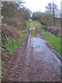
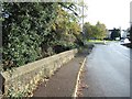
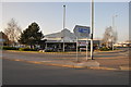
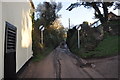
Photos of EX2 8FH

Area Information
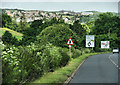
Living in EX2 8FH means inhabiting a compact, residential postcode area in England, covering just 1.3 hectares. With a population of 1,221 people, the area has a population density of 538 people per square kilometre, suggesting a tightly knit community. This small cluster is characterised by its focus on housing, with 73% of residents owning their homes. The median age of 47 and the prevalence of adults aged 30–64 indicate a mature, stable demographic. Daily life here is likely shaped by proximity to nearby amenities, including rail stations and retail outlets. While the area lacks natural or protected sites, its practical connectivity to Exeter and surrounding towns makes it a viable choice for those prioritising accessibility over rural landscapes. The absence of significant planning constraints or environmental risks further simplifies living here, though the moderate crime risk requires standard precautions. For buyers seeking a small, owner-occupied community with straightforward infrastructure, EX2 8FH offers a straightforward proposition.
- Area Type
- Postcode
- Area Size
- 1.3 hectares
- Population
- 1221
- Population Density
- 538 people/km²
The property market in EX2 8FH is dominated by owner-occupied houses, with 73% of residents owning their homes. This high home ownership rate suggests a stable, long-term community with limited rental activity, which may make the area less appealing to investors seeking short-term returns. The prevalence of houses rather than flats or apartments indicates a focus on traditional, family-friendly housing stock. Given the area’s small size—just 1.3 hectares—there is likely limited scope for new developments, meaning buyers should consider the immediate surroundings for more property options. The compact nature of EX2 8FH also means that proximity to transport links and amenities is a key selling point, potentially driving demand for homes near rail stations and retail hubs. For buyers prioritising security and a mature demographic, the area’s property market offers a straightforward, if unexciting, proposition.
House Prices in EX2 8FH
Showing 12 properties
| Address | Type | Beds | Baths | Last Sale Price | Last Sale Date | |
|---|---|---|---|---|---|---|
| 17 Pulpit Walk, Exeter, EX2 8FH | Detached | 5 | 2 | £460,000 | Jul 2020 | |
| 5 Pulpit Walk, Exeter, EX2 8FH | Detached | 4 | 2 | £485,000 | Dec 2018 | |
| 9 Pulpit Walk, Exeter, EX2 8FH | Detached | 4 | - | £375,000 | Aug 2016 | |
| 3 Pulpit Walk, Exeter, EX2 8FH | house | 2 | - | £185,000 | Oct 2010 | |
| 15 Pulpit Walk, Exeter, EX2 8FH | house | - | - | £299,950 | Nov 2009 | |
| 2 Pulpit Walk, Exeter, EX2 8FH | Detached | - | - | £320,000 | Apr 2008 | |
| 11 Pulpit Walk, Exeter, EX2 8FH | Detached | - | - | £170,000 | Apr 2000 | |
| 7 Pulpit Walk, Exeter, EX2 8FH | Detached | - | - | £122,000 | Aug 1998 | |
| 4 Pulpit Walk, Exeter, EX2 8FH | Detached | - | - | - | - | |
| 1 Pulpit Walk, Exeter, EX2 8FH | Terraced | - | - | - | - |
Energy Efficiency in EX2 8FH
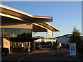
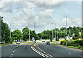
Residents of EX2 8FH have access to a range of practical amenities within reach. Retail options include Spar, Lidl Marsh, and Makro Exeter, providing everyday shopping convenience. The area’s rail network, with stations such as Marsh Barton and Exeter Central, facilitates easy travel to Exeter’s city centre and beyond. Ferry services like Topsham Lock and Turf Lock Inn offer additional transport links, particularly for those near waterways. The proximity to Exeter International Airport adds to the area’s appeal for frequent travellers. While the area lacks large-scale leisure facilities, its compact size ensures that essential services are within walking or short driving distance. The combination of retail, transport, and travel options creates a lifestyle that balances convenience with the need for minimal commuting, making it suitable for those prioritising accessibility over expansive amenities.
Amenities
Schools
| Rank | School | Type | Entry gender | Ages |
|---|
Explore more schools in this area
Go to Schools tabDemographics
The community in EX2 8FH is predominantly composed of adults aged 30–64, with a median age of 47. This suggests a population that is largely in their prime working years, potentially contributing to a stable local economy. Home ownership is high, with 73% of residents owning their homes, indicating a preference for long-term residency over renting. The accommodation type is primarily houses, which aligns with the area’s compact size and residential focus. The predominant ethnic group is White, though no specific data on diversity or deprivation is provided. The population density of 538 people per square kilometre implies a mix of family homes and single households, but the lack of detailed household composition data limits further analysis. The absence of protected natural sites or planning constraints may also reflect the area’s low environmental sensitivity, though this does not necessarily indicate a lack of green spaces.
Household Size
Accommodation Type
Tenure
Ethnic Group
Religion
Household Composition
Age
Household Deprivation
NS-SEC
Explore more demographic insights in this area
Go to Demographics tabPlanning
Planning Constraints
- Flood RiskPremium
- Ramsar Wetland SitesPremium
- Area of Outstanding Natural BeautyPremium
- Protected Nature ReservePremium
- Protected WoodlandPremium