Area Overview for EX2 8ED
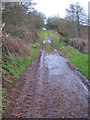
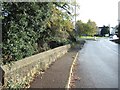
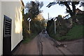
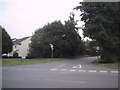
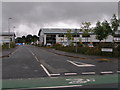
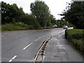
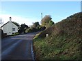
Photos of EX2 8ED


Area Information
Living in EX2 8ED means inhabiting a tightly knit residential cluster in England, where 1,221 people reside across 7.7 hectares. The area’s compact size fosters a sense of familiarity, with homes predominantly occupied by owners (73%) and occupied by adults aged 30–64. Daily life here is shaped by proximity to transport hubs, including five railway stations within reach, such as Marsh Barton and Exeter St Thomas, and ferry services like Topsham Lock Ferry Landing. The postcode’s small footprint means amenities are close, with shops like Lidl Marsh and Spar within walking distance. While the area lacks natural reserves or protected landscapes, its connectivity to Exeter International Airport and major rail routes positions it as a practical base for commuters. The population density of 538 people per square kilometre reflects a balance between residential comfort and urban accessibility. For buyers, EX2 8ED offers a blend of traditional housing and strategic location, though the flood risk score of 96.96 demands careful consideration.
- Area Type
- Postcode
- Area Size
- 7.7 hectares
- Population
- 1221
- Population Density
- 538 people/km²
The property market in EX2 8ED is characterised by a high rate of home ownership (73%), with houses forming the majority of the housing stock. This suggests a market skewed towards owner-occupied properties rather than rentals, likely due to the area’s compact size and established resident base. The small area size of 7.7 hectares means the housing stock is limited, with properties concentrated in a tight radius. Buyers should consider the proximity to transport links, including five railway stations and ferry services, which may influence property values. The predominance of houses implies a focus on traditional, often larger homes, which may appeal to families or those seeking private living. However, the flood risk score of 96.96 could impact insurance costs and property desirability, requiring careful due diligence for prospective buyers.
House Prices in EX2 8ED
Showing 2 properties
| Address | Type | Beds | Baths | Last Sale Price | Last Sale Date | |
|---|---|---|---|---|---|---|
| First Floor, Stratford House, Waterbridge Court, Matford, Exeter, EX2 8ED | Office | - | - | - | - | |
| Kastner Exeter, Waterbridge Court, Matford, Exeter, EX2 8ED | shop | - | - | - | - |
Energy Efficiency in EX2 8ED
Residents of EX2 8ED have access to a range of local amenities, including five retail outlets such as Makro Exeter, Lidl Marsh, and Spar, ensuring everyday shopping needs are met. The area’s transport links extend beyond rail, with ferry services like Topsham Ferry Landing offering alternative routes for travel or leisure. While natural reserves are absent, the proximity to Exeter’s urban core provides access to cultural and recreational facilities. The compact size of the area means amenities are closely clustered, fostering convenience. However, the lack of protected parks or green spaces may limit opportunities for outdoor activities. Dining and leisure options are inferred from retail presence, though specific venues are not detailed. Overall, the lifestyle here balances practicality with the need for connectivity and accessibility.
Amenities
Schools
| Rank | School | Type | Entry gender | Ages |
|---|
Explore more schools in this area
Go to Schools tabDemographics
The community in EX2 8ED is predominantly composed of adults aged 30–64, with a median age of 47. This suggests a mature population, likely with established careers and family ties to the area. Home ownership is high at 73%, indicating a stable, long-term resident base. The accommodation type is primarily houses, reflecting a preference for private, detached living. The predominant ethnic group is White, though specific data on diversity or deprivation is not provided. The age profile implies a demand for schools and healthcare services tailored to families and older adults. With no data on income distribution or deprivation levels, the area’s quality of life is inferred from its infrastructure and connectivity. The absence of protected natural areas or planning constraints suggests a focus on residential convenience over environmental preservation.
Household Size
Accommodation Type
Tenure
Ethnic Group
Religion
Household Composition
Age
Household Deprivation
NS-SEC
Explore more demographic insights in this area
Go to Demographics tabPlanning
Planning Constraints
- Flood RiskPremium
- Ramsar Wetland SitesPremium
- Area of Outstanding Natural BeautyPremium
- Protected Nature ReservePremium
- Protected WoodlandPremium