Area Overview for EX2 8BP
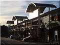
Photos of EX2 8BP


Area Information
Living in EX2 8BP means inhabiting a compact, densely populated residential cluster in England. The area spans just 2.3 hectares, housing 1,541 people in a high-density arrangement of 66,370 people per square kilometre. This small postcode area is likely part of a larger urban or semi-urban setting, given its proximity to Exeter’s rail network and ferry services. Daily life here is characterised by close-knit living, with residents relying on nearby amenities for shopping, transport, and leisure. The area’s strategic location near Exeter St Thomas Railway Station and Exeter International Airport offers connectivity to regional and national destinations. While the population is relatively small, the presence of five retail outlets, including Co-op Haven and Spar Quayside, suggests a functional, practical approach to local needs. The area’s compact nature means residents are likely within walking or short driving distance of key services, though its limited size may restrict opportunities for larger-scale community events or green spaces.
- Area Type
- Postcode
- Area Size
- 2.3 hectares
- Population
- 1541
- Population Density
- 2569 people/km²
The property market in EX2 8BP is defined by its compact size and prevalence of flats. With 42% of homes owned by residents, the area is neither fully owner-occupied nor heavily rental-driven, but the dominance of flats suggests a focus on smaller, manageable units. This housing type is typical in high-density areas, often appealing to couples or single occupants seeking affordability. Given the postcode’s small size, the immediate surroundings may offer limited scope for property expansion, making EX2 8BP a niche market for buyers seeking proximity to transport hubs and amenities. The presence of multiple rail stations and ferry landings nearby could enhance the area’s appeal, particularly for commuters. However, buyers should consider the limited space and potential for overcrowding, as the high population density may strain local infrastructure. For those prioritising location over property size, this area offers a practical, if constrained, housing option.
House Prices in EX2 8BP
Showing 20 properties
| Address | Type | Beds | Baths | Last Sale Price | Last Sale Date | |
|---|---|---|---|---|---|---|
| 2, Hove Villas, Haven Road, Exeter, EX2 8BP | Terraced | 3 | 1 | £299,000 | Sep 2024 | |
| 4, Hove Villas, Haven Road, Exeter, EX2 8BP | Terraced | 3 | 1 | £278,000 | Oct 2022 | |
| 5, Hove Villas, Haven Road, Exeter, EX2 8BP | Terraced | 3 | 1 | £220,000 | Sep 2017 | |
| 6 Haven Road, Exeter, EX2 8BP | house | 1 | - | £226,000 | Jan 2017 | |
| 1, Hove Villas, Haven Road, Exeter, EX2 8BP | Terraced | 3 | - | £164,000 | Apr 2013 | |
| 10 Haven Road, Exeter, EX2 8BP | house | 2 | - | £125,000 | Oct 2005 | |
| 8 Haven Road, Exeter, EX2 8BP | Semi-detached | 4 | 2 | £101,500 | Aug 2001 | |
| 12 Haven Road, Exeter, EX2 8BP | Terraced | 2 | 1 | £57,000 | Oct 2000 | |
| 39 Haven Road, Exeter, EX2 8BP | Terraced | - | - | £56,000 | Oct 1998 | |
| 1A Haven Road, Exeter, EX2 8BP | Flat | 3 | 1 | - | - |
Energy Efficiency in EX2 8BP
The lifestyle in EX2 8BP is shaped by its proximity to essential amenities and transport links. Retail options include Co-op Haven, M&S Exebridges Exeter SF, and Spar Quayside, providing access to groceries, clothing, and daily essentials. The area’s rail network, with stations such as Exeter St Thomas and Exeter St Davids, offers seamless connections to Exeter’s cultural and commercial hubs. Ferry services like Topsham Lock Ferry Landing add flexibility for local travel, while Exeter International Airport caters to broader travel needs. Though the area is small, its amenities are practical and well-served, reducing the need for long commutes. However, the limited size of EX2 8BP means residents may need to venture slightly beyond the postcode for more diverse leisure options. The balance of convenience and proximity makes it appealing for those prioritising accessibility over expansive local facilities.
Amenities
Schools
| Rank | School | Type | Entry gender | Ages |
|---|
Explore more schools in this area
Go to Schools tabDemographics
The community in EX2 8BP is predominantly composed of adults aged 30–64, with a median age of 47. This suggests a mature population, likely settled in long-term housing rather than transient rental properties. Home ownership rates here stand at 42%, indicating a mix of owner-occupied and rental properties. The accommodation type is primarily flats, reflecting a housing stock suited to smaller households or couples. The predominant ethnic group is White, with no specific data provided on other demographics. The high population density—66,370 people per square kilometre—means the area is intensely populated, which may influence local infrastructure demands. While the data does not specify deprivation levels, the combination of high density and flat-dominated housing suggests a focus on affordability over spacious living. This profile aligns with a community prioritising proximity to transport and services over expansive private space.
Household Size
Accommodation Type
Tenure
Ethnic Group
Religion
Household Composition
Age
Household Deprivation
NS-SEC
Explore more demographic insights in this area
Go to Demographics tabPlanning
Planning Constraints
- Flood RiskPremium
- Ramsar Wetland SitesPremium
- Area of Outstanding Natural BeautyPremium
- Protected Nature ReservePremium
- Protected WoodlandPremium