Area Overview for EX2 8BE
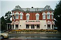
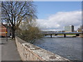
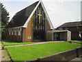
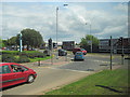
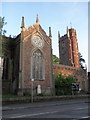
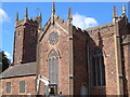
Photos of EX2 8BE

Area Information
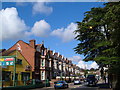
Living in EX2 8BE offers a compact, densely populated residential experience in a small cluster of homes. With a population of 1,541 spread over 3,428 square metres, this area is characterised by a high population density of 449,580 people per square kilometre. It is a place where daily life is shaped by proximity to essential services and transport links. The area’s small size means residents are likely to know their neighbours, though the high density may also create a sense of shared space. EX2 8BE sits near Exeter’s rail network, with multiple stations within reach, and is close to ferry landings and Exeter International Airport, offering varied connectivity. While the area is residential, its compact nature means amenities are concentrated, requiring a walk or short journey to access shops, transport, or leisure. The demographic profile suggests a mature community, with a median age of 47 and a strong presence of adults aged 30–64. This mix of factors makes EX2 8BE a practical, if tightly packed, choice for those prioritising accessibility over expansive living space.
- Area Type
- Postcode
- Area Size
- 3428 m²
- Population
- 1541
- Population Density
- 2569 people/km²
The property market in EX2 8BE is defined by a 42% home ownership rate, with flats making up the predominant accommodation type. This suggests a housing stock that is largely purpose-built or converted for smaller households, typical of areas with high population density. The low percentage of owner-occupied homes may indicate that the area is more rental-focused, though the exact balance between rental and ownership is not specified. The compact size of EX2 8BE—just 3,428 square metres—means the available housing stock is limited, which could make property searches challenging for buyers. Flats in this area are likely to be in multi-unit buildings, possibly with shared amenities. For prospective buyers, this small area may require looking beyond its immediate boundaries to find comparable properties. The high population density also implies that the area is fully developed, with little scope for new construction, making it a niche market for those seeking a specific type of urban living.
House Prices in EX2 8BE
Showing 1 properties
| Address | Type | Beds | Baths | Last Sale Price | Last Sale Date | |
|---|---|---|---|---|---|---|
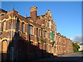
| Greenslades Nursing Home, Willeys Avenue, Exeter, EX2 8BE | hospital_care_home | - | - | - | - |
Energy Efficiency in EX2 8BE
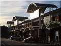
Living in EX2 8BE provides access to a range of nearby amenities, from retail to transport hubs. The area is within walking distance of shops like Aldi St, Iceland Alphington, and Co-op Haven, offering everyday essentials. For commuters, rail stations such as Exeter St Thomas and Exeter Central provide regular services, while ferry landings like Topsham Lock and Turf Lock Inn connect to nearby waterways. Exeter International Airport is also nearby, making travel convenient for those needing regional or international connections. The compact nature of the area means residents can reach these amenities without long journeys, fostering a sense of convenience. While the data does not specify parks or leisure facilities, the proximity to Exeter’s urban centres suggests access to cultural and recreational options. The combination of retail, transport, and travel infrastructure creates a practical, if small-scale, lifestyle that prioritises accessibility over expansive living spaces.
Amenities
Schools
| Rank | School | Type | Entry gender | Ages |
|---|
Explore more schools in this area
Go to Schools tabDemographics
The community in EX2 8BE is predominantly composed of adults aged 30–64, with a median age of 47. This suggests a mature population, likely with established careers and families. Home ownership is relatively low at 42%, indicating that a significant portion of residents may be renters or in other housing arrangements. The accommodation type is primarily flats, reflecting the area’s compact design and likely urban or semi-urban setting. The predominant ethnic group is White, though the data does not specify further diversity metrics. The high population density—449,580 people per square kilometre—implies a tightly packed living environment, which may influence the character of daily life. While the data does not include deprivation figures, the combination of high density and limited housing stock could suggest a community where shared resources and communal spaces are more prominent. This demographic profile indicates a place where stability and proximity to services are prioritised over expansive personal space.
Household Size
Accommodation Type
Tenure
Ethnic Group
Religion
Household Composition
Age
Household Deprivation
NS-SEC
Explore more demographic insights in this area
Go to Demographics tabPlanning
Planning Constraints
- Flood RiskPremium
- Ramsar Wetland SitesPremium
- Area of Outstanding Natural BeautyPremium
- Protected Nature ReservePremium
- Protected WoodlandPremium