Area Overview for EX2 7TR
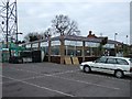
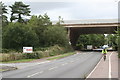
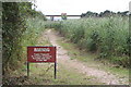
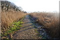
Photos of EX2 7TR

Area Information
Living in EX2 7TR means inhabiting a tightly knit residential cluster in England, where 1,827 people reside across just 1.6 hectares. The area’s compact size fosters a close-knit community, with a population density of 1,132 people per square kilometre. Daily life here is characterised by proximity to essential services, from retail outlets to transport links. The postcode’s small footprint means residents often know their neighbours, yet it remains connected to broader networks through nearby rail stations, ferries, and Exeter International Airport. The area’s appeal lies in its balance of residential tranquillity and practical accessibility, making it suitable for those prioritising convenience without sacrificing a sense of local identity. With no significant environmental constraints like protected woodlands or AONB designations, the area offers straightforward living without bureaucratic hurdles. However, its limited size means buyers should consider nearby options for larger housing needs, while the median age of 47 suggests a mature, stable demographic.
- Area Type
- Postcode
- Area Size
- 1.6 hectares
- Population
- 1827
- Population Density
- 1132 people/km²
The property market in EX2 7TR is dominated by owner-occupied homes, with 69% of residents owning their properties. The area’s housing stock consists mainly of houses, which is unusual for a small postcode but suggests a focus on family-friendly, single-unit dwellings. This configuration indicates a market skewed towards long-term residents rather than renters, though the limited size of the area may mean buyers need to look beyond EX2 7TR for larger or more varied options. The high home ownership rate implies a stable market with potentially lower turnover, but the scarcity of properties could make competition fierce for available homes. Given the area’s compact nature, buyers should consider nearby postcode areas for additional choices, particularly if seeking different property types or sizes.
House Prices in EX2 7TR
Showing 30 properties
| Address | Type | Beds | Baths | Last Sale Price | Last Sale Date | |
|---|---|---|---|---|---|---|
| 6 Fish Street, Exeter, EX2 7TR | Terraced | 3 | 1 | £100,500 | Nov 2024 | |
| 24 Fish Street, Exeter, EX2 7TR | Semi-detached | 2 | 2 | £330,000 | Oct 2022 | |
| 1 Fish Street, Exeter, EX2 7TR | house | - | - | £123,939 | Aug 2021 | |
| 30 Fish Street, Exeter, EX2 7TR | Semi-detached | 3 | 3 | £345,000 | Mar 2021 | |
| 32 Fish Street, Exeter, EX2 7TR | Detached | 3 | 2 | £380,000 | Feb 2021 | |
| 23 Fish Street, Exeter, EX2 7TR | house | - | - | £175,530 | Feb 2021 | |
| 26 Fish Street, Exeter, EX2 7TR | Semi-detached | 2 | 2 | £285,000 | Dec 2020 | |
| 28 Fish Street, Exeter, EX2 7TR | Semi-detached | 3 | 2 | £292,000 | Dec 2020 | |
| 22 Fish Street, Exeter, EX2 7TR | house | - | - | £285,000 | Dec 2020 | |
| 18 Fish Street, Exeter, EX2 7TR | Semi-detached | 3 | 2 | £320,000 | Nov 2020 |
Energy Efficiency in EX2 7TR
Residents of EX2 7TR have access to a range of amenities within practical reach. Retail options include Aldi Countess, Spar Blakeslee, and Tesco Exeter, ensuring daily shopping needs are met. The area’s rail network, with stations like Newcourt and Topsham, connects to broader transport systems, while ferry services at Topsham Lock and Turf Lock Inn provide scenic and functional travel routes. Exeter International Airport is a notable nearby feature, offering direct access to national and international destinations. These amenities contribute to a lifestyle that balances local convenience with regional connectivity. The presence of multiple retail and transport options suggests a practical, well-served community, though the absence of parks or leisure facilities beyond transport hubs may require residents to travel further for recreational activities.
Amenities
Schools
The nearest school to EX2 7TR is Elm Grove School, an independent institution. No other schools are listed in the data, meaning families in the area must rely on this single option for education. As an independent school, Elm Grove likely operates outside the state-funded system, which may affect accessibility for those without the financial means to pay tuition fees. The absence of other schools, including state-run or specialist institutions, limits the diversity of educational choices available to residents. Families considering EX2 7TR should investigate whether Elm Grove meets their child’s needs, including academic standards, extracurricular opportunities, and affordability.
| Rank | School | Type | Entry gender | Ages |
|---|
Explore more schools in this area
Go to Schools tabDemographics
The community in EX2 7TR is predominantly composed of adults aged 30–64, with a median age of 47. Home ownership is high at 69%, reflecting a population that values long-term stability. The accommodation type is primarily houses, indicating a lack of high-density housing or flats. The predominant ethnic group is White, and no data suggests significant ethnic diversity beyond this. The population density of 1,132 people per square kilometre implies a moderately crowded environment, which may influence the character of public spaces and social interactions. While no specific deprivation data is provided, the high home ownership and age profile suggest a relatively affluent and established community. However, the absence of detailed diversity metrics means the area’s social fabric remains largely defined by its older, predominantly White residents.
Household Size
Accommodation Type
Tenure
Ethnic Group
Religion
Household Composition
Age
Household Deprivation
NS-SEC
Explore more demographic insights in this area
Go to Demographics tabPlanning
Planning Constraints
- Flood RiskPremium
- Ramsar Wetland SitesPremium
- Area of Outstanding Natural BeautyPremium
- Protected Nature ReservePremium
- Protected WoodlandPremium