Area Overview for EX2 7SR
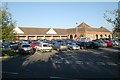
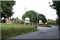
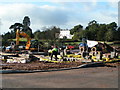
Photos of EX2 7SR


Area Information
Living in EX2 7SR means being part of a tightly knit residential cluster in England, where 2120 people reside across 5434 square metres. The area’s compact size and high population density of 1853 people per square kilometre reflect a community-oriented environment. This postcode is characterised by a mature demographic, with a median age of 47 and a majority of residents aged 30-64. The area’s proximity to amenities such as schools, rail stations, and ferry landings makes it practical for daily life. While it is not a sprawling suburb, its small footprint ensures a sense of familiarity and accessibility. Residents benefit from a mix of retail options, including Spar Blakeslee and Tesco Exeter, and easy access to Exeter International Airport. The area’s compact nature means that essential services are within walking or short driving distance, though its limited size may restrict expansion. For those seeking a balanced blend of convenience and community, EX2 7SR offers a distinct, focused living experience.
- Area Type
- Postcode
- Area Size
- 5434 m²
- Population
- 2120
- Population Density
- 1853 people/km²
The property market in EX2 7SR is characterised by a high rate of home ownership (66%), with houses being the predominant accommodation type. This suggests a community of long-term residents rather than a transient rental market. The area’s small size means that housing stock is limited, but the focus on owner-occupied properties indicates a strong local presence. Buyers should expect a mix of residential properties, though the compact nature of the postcode may restrict availability. The high home ownership rate also implies that the area is less likely to experience rapid price fluctuations, offering a degree of stability for investors. For those seeking a family home, the prevalence of houses may be appealing, though the limited land area means that new developments are unlikely. The market’s character is defined by its residential focus, with properties likely to cater to the needs of mature households and families.
House Prices in EX2 7SR
Showing 12 properties
| Address | Type | Beds | Baths | Last Sale Price | Last Sale Date | |
|---|---|---|---|---|---|---|
| 7 Edmunds Way, Exeter, EX2 7SR | Detached | 3 | 2 | £615,000 | Mar 2025 | |
| 3 Edmunds Way, Exeter, EX2 7SR | Detached | 4 | 2 | £800,000 | Sep 2023 | |
| 4 Edmunds Way, Exeter, EX2 7SR | Terraced | 3 | 2 | £382,500 | May 2023 | |
| 6 Edmunds Way, Exeter, EX2 7SR | house | - | - | £250,000 | Nov 2021 | |
| 9 Edmunds Way, Exeter, EX2 7SR | Detached | 3 | 2 | £560,000 | Oct 2021 | |
| 11 Edmunds Way, Exeter, EX2 7SR | Detached | 3 | 2 | £575,000 | Sep 2021 | |
| 2 Edmunds Way, Exeter, EX2 7SR | house | - | - | £536,750 | Sep 2021 | |
| 5 Edmunds Way, Exeter, EX2 7SR | house | - | - | £485,000 | Aug 2021 | |
| 1 Edmunds Way, Exeter, EX2 7SR | Detached | 3 | 2 | £555,000 | Jul 2021 | |
| 10 Edmunds Way, Exeter, EX2 7SR | house | - | - | - | - |
Energy Efficiency in EX2 7SR
The lifestyle in EX2 7SR is shaped by its proximity to a range of amenities. Retail options include Spar Blakeslee, Tesco Exeter, and Aldi Countess, providing everyday shopping convenience. The area’s rail stations, such as Digby & Sowton Railway Station, connect residents to regional hubs, while ferry landings like Topsham Ferry Landing offer alternative routes. The presence of Exeter International Airport nearby adds to the area’s accessibility for travel. For leisure, the compact size of the postcode means that parks or green spaces are not explicitly mentioned, though the absence of protected natural areas suggests that recreational options may be limited to local trails or public spaces. The combination of retail, transport, and travel links creates a practical, if modest, lifestyle. Residents benefit from a balance of convenience and connectivity, though the area’s small size means that larger-scale amenities may require a short journey.
Amenities
Schools
Residents of EX2 7SR have access to two primary schools: Trinity Church of England Voluntary Aided Primary and Nursery School and Trinity CofE Primary and Nursery School. Both institutions serve the local community, offering education for younger children. While no Ofsted ratings are provided, the presence of two primary schools within the area suggests a focus on early education and family needs. For parents, this proximity reduces commuting time and ensures children are near educational facilities. However, the absence of secondary schools or higher education institutions nearby means that families may need to consider additional transport arrangements for older children. The dual presence of primary schools also indicates that the area supports a consistent demand for early-years education, which aligns with the community’s demographic profile of adults aged 30-64.
| Rank | School | Type | Entry gender | Ages |
|---|
Explore more schools in this area
Go to Schools tabDemographics
The community in EX2 7SR is predominantly composed of adults aged 30-64, with a median age of 47. This suggests a mature, stable population, likely with established careers and families. Home ownership is high, with 66% of residents owning their homes, indicating a long-term commitment to the area. The accommodation type is primarily houses, which aligns with the demographic profile of older, family-oriented households. The predominant ethnic group is White, though no further diversity data is provided. The absence of significant deprivation data means that quality of life factors such as access to services and safety are not explicitly quantified here. However, the presence of two primary schools and multiple transport links suggests that the area meets basic needs. The high population density, combined with a focus on owner-occupied housing, points to a community that prioritises stability and proximity to essential amenities.
Household Size
Accommodation Type
Tenure
Ethnic Group
Religion
Household Composition
Age
Household Deprivation
NS-SEC
Explore more demographic insights in this area
Go to Demographics tabPlanning
Planning Constraints
- Flood RiskPremium
- Ramsar Wetland SitesPremium
- Area of Outstanding Natural BeautyPremium
- Protected Nature ReservePremium
- Protected WoodlandPremium