Area Overview for EX2 7RL
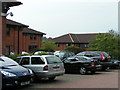
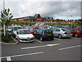
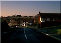
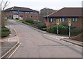
Photos of EX2 7RL


Area Information
Living in EX2 7RL means being part of a tightly knit, small-scale residential cluster in England. The area covers 5,566 square metres and is home to 1,458 residents, creating a densely populated yet compact community. With a population density of 261,943 people per square kilometre, this postcode is a microcosm of everyday life, where proximity to amenities and neighbours is a defining feature. The area’s small size fosters a sense of familiarity, with residents likely to know their immediate surroundings well. It is a place where practicality meets convenience, with nearby rail stations, retail hubs, and ferry access within reach. The median age of 47 suggests a mature population, with a strong presence of adults aged 30–64. For those seeking a balance between urban accessibility and residential tranquillity, EX2 7RL offers a snapshot of life in a well-connected yet intimate setting.
- Area Type
- Postcode
- Area Size
- 5566 m²
- Population
- 1458
- Population Density
- 5333 people/km²
The property market in EX2 7RL is characterised by a 50% home ownership rate, indicating a balance between owner-occupied and rental properties. The accommodation type is predominantly houses, which is notable in a small postcode area. This suggests a limited but focused housing stock, likely comprising semi-detached or detached homes. Given the area’s size and population density, the market is unlikely to offer a wide range of property types, making it a niche market for buyers seeking single-family homes. The 50% ownership rate implies that a significant portion of the housing stock is rented, which could influence availability for purchase. For those considering EX2 7RL, the market’s compact nature means competition for properties is likely to be keen, with limited scope for new developments given the area’s small footprint.
House Prices in EX2 7RL
Showing 24 properties
| Address | Type | Beds | Baths | Last Sale Price | Last Sale Date | |
|---|---|---|---|---|---|---|
| 5 Edwards Court, Exeter, EX2 7RL | Terraced | 3 | 2 | £290,000 | Jan 2025 | |
| 16 Edwards Court, Exeter, EX2 7RL | Flat | 2 | 1 | £230,000 | Jun 2024 | |
| 1 Edwards Court, Exeter, EX2 7RL | Terraced | 2 | 1 | £246,000 | Feb 2023 | |
| 23 Edwards Court, Exeter, EX2 7RL | house | 3 | 1 | £325,000 | Sep 2022 | |
| 9 Edwards Court, Exeter, EX2 7RL | Semi-detached | 3 | 2 | £320,000 | Sep 2022 | |
| 2 Edwards Court, Exeter, EX2 7RL | Terraced | 3 | 3 | £296,000 | Sep 2021 | |
| 8 Edwards Court, Exeter, EX2 7RL | Flat | - | - | £175,000 | Jun 2021 | |
| 10 Edwards Court, Exeter, EX2 7RL | Semi-detached | 1 | 1 | £170,000 | Jun 2021 | |
| 21 Edwards Court, Exeter, EX2 7RL | Semi-detached | 3 | 2 | £260,000 | Apr 2021 | |
| 25 Edwards Court, Exeter, EX2 7RL | Detached | 2 | - | £202,500 | Feb 2017 |
Energy Efficiency in EX2 7RL
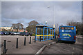
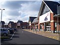
Life in EX2 7RL is supported by a range of amenities within easy reach. Retail options include major supermarkets like Tesco Exeter and Lidl Heavitree, as well as M&S Exeter, offering a mix of everyday shopping needs. The five nearby rail stations provide seamless access to local and regional destinations, while three ferry landings, including Topsham Ferry Landing, offer alternative transport routes along the river. Exeter International Airport is a short trip away, catering to those with travel needs. The area’s proximity to these amenities ensures convenience for daily life, whether for commuting, grocery shopping, or leisure. The presence of multiple transport options, combined with retail and ferry access, creates a lifestyle that balances practicality with connectivity, making EX2 7RL a functional base for both daily errands and broader travel.
Amenities
Schools
The nearest school to EX2 7RL is Clyst Heath Nursery and Community Primary School, which serves as a primary education provider for local children. While no Ofsted rating is provided, the presence of a primary school within the area suggests that families with young children have access to essential educational infrastructure. The absence of secondary schools in the data implies that students may need to travel to nearby postcodes for further education. This school is likely a focal point for the community, offering early years education and a foundation for local children’s schooling. For families prioritising proximity to schools, Clyst Heath’s primary offering is a key consideration, though additional research into secondary options would be necessary for long-term planning.
| Rank | School | Type | Entry gender | Ages |
|---|
Explore more schools in this area
Go to Schools tabDemographics
The community in EX2 7RL is predominantly composed of adults aged 30–64, with a median age of 47. This reflects a mature, settled population, likely with established careers and families. Home ownership stands at 50%, indicating a mix of owner-occupied properties and rental units. The accommodation type is primarily houses, which aligns with the area’s small scale and residential character. The predominant ethnic group is White, though no specific data on diversity or deprivation is provided. The high population density of 261,943 people per square kilometre suggests a compact, possibly multi-generational living environment. While this density may impact space availability, it also implies a strong local network and proximity to services. For buyers, this demographic profile suggests a community focused on stability, with a balance between private and rental housing.
Household Size
Accommodation Type
Tenure
Ethnic Group
Religion
Household Composition
Age
Household Deprivation
NS-SEC
Explore more demographic insights in this area
Go to Demographics tabPlanning
Planning Constraints
- Flood RiskPremium
- Ramsar Wetland SitesPremium
- Area of Outstanding Natural BeautyPremium
- Protected Nature ReservePremium
- Protected WoodlandPremium