Area Overview for EX2 7PT
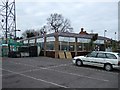
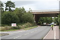
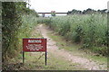
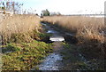
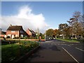
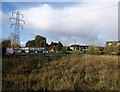
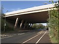
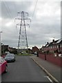
Photos of EX2 7PT


Area Information
Living in EX2 7PT means inhabiting a compact, residential cluster of 4.1 hectares that supports a population of 1,827 people. With a population density of 1,132 people per square kilometre, the area fosters a tight-knit community where proximity to amenities and services is a daily reality. The median age of 47 suggests a mature demographic, with the majority of residents aged 30–64. This age group often balances family life with professional stability, reflected in the high home ownership rate of 69% and the prevalence of houses as the primary accommodation type. The area’s small footprint means residents are likely to know their neighbours, and local amenities are within walking or short driving distance. Nearby, the independent Elm Grove School and multiple rail stations provide practical connectivity, while the proximity to Exeter International Airport adds to the area’s accessibility. Life here is defined by a blend of residential calm and practical convenience, with a focus on established communities over rapid expansion.
- Area Type
- Postcode
- Area Size
- 4.1 hectares
- Population
- 1827
- Population Density
- 1132 people/km²
The property market in EX2 7PT is predominantly owner-occupied, with 69% of homes owned by their residents rather than rented. This suggests a stable market where long-term investment is common, and property values are likely to reflect the area’s established character. The accommodation type is primarily houses, which are more common than flats or apartments. This housing stock may appeal to families or individuals seeking space and privacy, though the small area size means the total number of properties is limited. Buyers should consider that the immediate surroundings may offer similar housing stock, but the proximity to rail stations, schools, and retail amenities could enhance property desirability. The high home ownership rate also indicates that the area is less reliant on rental demand, which may affect price volatility. For those seeking a home, the compact nature of EX2 7PT means proximity to key services is a strong selling point.
House Prices in EX2 7PT
Showing 13 properties
| Address | Type | Beds | Baths | Last Sale Price | Last Sale Date | |
|---|---|---|---|---|---|---|
| 13 Ronald Gardens, Exeter, EX2 7PT | house | - | - | £334,950 | Dec 2019 | |
| 12 Ronald Gardens, Exeter, EX2 7PT | Maisonette | - | - | £274,950 | Oct 2019 | |
| 1 Ronald Gardens, Exeter, EX2 7PT | house | - | - | £329,950 | Mar 2019 | |
| 7 Ronald Gardens, Exeter, EX2 7PT | house | - | - | - | - | |
| 10 Ronald Gardens, Exeter, EX2 7PT | house | - | - | - | - | |
| 11 Ronald Gardens, Exeter, EX2 7PT | house | - | - | - | - | |
| 3 Ronald Gardens, Exeter, EX2 7PT | house | - | - | - | - | |
| 8 Ronald Gardens, Exeter, EX2 7PT | Bungalow | - | - | - | - | |
| 4 Ronald Gardens, Exeter, EX2 7PT | house | - | - | - | - | |
| 6 Ronald Gardens, Exeter, EX2 7PT | house | - | - | - | - |
Energy Efficiency in EX2 7PT
Residents of EX2 7PT have access to a range of practical amenities within easy reach. Retail options include Aldi Countess, Spar Blakeslee, and Tesco Exeter, providing everyday shopping needs. The area’s rail network connects to multiple stations, including Digby & Sowton Railway Station, facilitating travel to nearby hubs. Ferries at Topsham Lock and Turf Lock Inn offer additional transport routes, particularly for those using waterways for commuting or leisure. The proximity to Exeter International Airport enhances connectivity for travel. While the area’s compact size means a limited number of venues, the availability of shops, transport, and the airport ensures daily life is convenient. The mix of retail, transport, and travel options supports a lifestyle that balances local convenience with broader accessibility.
Amenities
Schools
The nearest school to EX2 7PT is Elm Grove School, an independent institution. Independent schools typically offer a range of educational approaches and may cater to specific pedagogical preferences, though they are usually fee-paying. The absence of state schools in the immediate vicinity means families considering EX2 7PT should assess whether Elm Grove’s offerings align with their needs or if they would need to look further afield for state education options. The single school listed in the data highlights a limited selection for families, which could be a factor in decision-making. However, the area’s proximity to rail stations may provide access to broader educational networks beyond the immediate postcode.
| Rank | School | Type | Entry gender | Ages |
|---|
Explore more schools in this area
Go to Schools tabDemographics
The demographic profile of EX2 7PT is characterised by a median age of 47, with the most common age range being adults aged 30–64. This suggests a population that is largely in their prime working years, with many likely to be raising families or nearing retirement. Home ownership is high at 69%, indicating a stable housing market where most residents are long-term occupants rather than renters. The predominant accommodation type is houses, which aligns with the area’s residential character and the presence of family-oriented households. The predominant ethnic group is White, though no specific data on diversity or deprivation is provided. The high population density of 1,132 people per square kilometre implies a compact, possibly urbanised setting, though the area’s small size means it is unlikely to have the sprawl of larger towns. This density may influence the availability of private green space but supports a vibrant local economy and community networks.
Household Size
Accommodation Type
Tenure
Ethnic Group
Religion
Household Composition
Age
Household Deprivation
NS-SEC
Explore more demographic insights in this area
Go to Demographics tabPlanning
Planning Constraints
- Flood RiskPremium
- Ramsar Wetland SitesPremium
- Area of Outstanding Natural BeautyPremium
- Protected Nature ReservePremium
- Protected WoodlandPremium