Area Overview for EX2 7FD
Photos of EX2 7FD
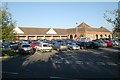
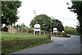
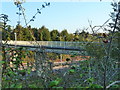
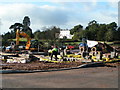


92 photos from this area
Area Information
Key information about the EX2 7FD including its size, population, and administrative classification.
- Area Type
- Postcode
- Area Size
- 9368 m²
- Population
- 2120
- Population Density
- 1853 people/km²
House Prices in EX2 7FD
34
Properties
£281,988
Average Sold Price
£157,000
Lowest Price
£1,925,000
Highest Price
Showing 34 properties
| Address | Type | Beds | Baths | Last Sale Price | Last Sale Date | |
|---|---|---|---|---|---|---|
| 26 River Plate Road, Exeter, EX2 7FD | Terraced | 4 | 2 | £1,925,000 | Dec 2025 | |
| 42 River Plate Road, Exeter, EX2 7FD | Terraced | 3 | 2 | £297,500 | Oct 2024 | |
| 16 River Plate Road, Exeter, EX2 7FD | Terraced | 3 | 2 | £297,500 | Aug 2024 | |
| 34 River Plate Road, Exeter, EX2 7FD | Terraced | 3 | 2 | £306,000 | Jul 2023 | |
| 52 River Plate Road, Exeter, EX2 7FD | Terraced | 3 | 2 | £310,000 | Nov 2022 | |
| 66 River Plate Road, Exeter, EX2 7FD | Flat | 2 | 1 | £195,000 | Aug 2022 | |
| 64 River Plate Road, Exeter, EX2 7FD | Flat | 2 | 1 | £188,000 | Jun 2022 | |
| 12 River Plate Road, Exeter, EX2 7FD | Terraced | 3 | 2 | £275,000 | May 2022 | |
| 8 River Plate Road, Exeter, EX2 7FD | Semi-detached | 4 | 2 | £370,100 | Mar 2022 | |
| 44 River Plate Road, Exeter, EX2 7FD | Terraced | 3 | 1 | £260,000 | Aug 2021 |
Page 1 of 4
Energy Efficiency in EX2 7FD
Amenities
Schools
| Rank | School | Type | Entry gender | Ages |
|---|
Explore more schools in this area
Go to Schools tabDemographics
Household Size
Family (3-5 people)
most common
Accommodation Type
Houses
most common
Tenure
66
majority
Ethnic Group
White
most common
Religion
N/A
most common
Household Composition
N/A
most common
Age
47
median
Adults (30-64 years)
most common
Household Deprivation
N/A
with no deprivation
NS-SEC
49
in Lower managerial occupations
Explore more demographic insights in this area
Go to Demographics tabPlanning
Planning Constraints
- Flood RiskPremium
- Ramsar Wetland SitesPremium
- Area of Outstanding Natural BeautyPremium
- Protected Nature ReservePremium
- Protected WoodlandPremium