Area Overview for EX2 5SX
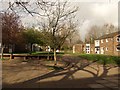
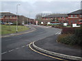
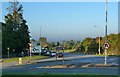
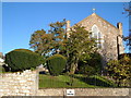
Photos of EX2 5SX


Area Information
Living in EX2 5SX offers a compact, tightly knit residential experience. With a population of 1,169 and a density of 829 people per square kilometre, this postcode area is a small cluster of homes, ideal for those seeking a close-knit community. The area’s proximity to essential services and transport links makes it practical for daily life. Residents benefit from nearby schools, including special education institutions like Southbrook School and Infocus College, catering to specific educational needs. The area’s demographics reflect a mature population, with a median age of 47 and a strong presence of adults aged 30–64. This suggests a stable, established community, with 80% of homes owned outright. The compact nature of EX2 5SX means residents are within easy reach of retail, rail, and ferry services, blending suburban comfort with accessibility. For buyers, this area represents a blend of practicality and convenience, though its small size means demand for properties is likely to be high.
- Area Type
- Postcode
- Area Size
- Not available
- Population
- 1169
- Population Density
- 829 people/km²
The property market in EX2 5SX is characterised by high home ownership, with 80% of homes owned outright. This suggests a stable, long-term resident base rather than a transient rental market. The accommodation type is predominantly houses, which is uncommon in many urban areas but typical of smaller, rural or semi-rural postcode clusters. This housing stock likely includes a mix of older properties and newer builds, though the data does not specify. The small size of the area means the housing stock is limited, which could drive up prices or reduce availability for buyers. For those seeking to purchase, the focus is on owner-occupied homes rather than rental properties. The compact nature of EX2 5SX also means that properties are likely to be in close proximity to essential services, making the area attractive for families or professionals prioritising convenience.
House Prices in EX2 5SX
No properties found in this postcode.
Energy Efficiency in EX2 5SX
Daily life in EX2 5SX is shaped by its proximity to a range of amenities. Retail options include major supermarkets like Tesco Exeter, Lidl Heavitree, and Morrisons Daily, ensuring easy access to groceries and everyday essentials. The area’s rail network connects residents to nearby towns and cities, while ferry services such as Topsham Ferry Landing offer scenic and practical transport links. Exeter International Airport is a short journey away, adding to the area’s appeal for frequent flyers. The compact nature of the postcode means residents are within walking or cycling distance of these amenities, fostering a sense of convenience. While the area lacks large parks or leisure facilities, its proximity to transport hubs and retail centres compensates with practicality. The mix of retail, transport, and travel options makes EX2 5SX a functional choice for those prioritising accessibility over expansive green spaces.
Amenities
Schools
The schools nearest to EX2 5SX include Southbrook School, Infocus School, and Infocus College, all of which are special education institutions. These schools cater to students with specific educational needs, making the area suitable for families requiring tailored support for their children. The presence of multiple special schools suggests a focus on inclusivity and accessibility in local education. While the data does not provide Ofsted ratings or academic performance metrics, the variety of institutions indicates a range of options for parents. For families with children requiring specialist education, this cluster of schools offers proximity and a dedicated focus. However, the absence of mainstream primary or secondary schools may mean residents need to travel further for general education, which is a consideration for prospective buyers.
| Rank | School | Type | Entry gender | Ages |
|---|
Explore more schools in this area
Go to Schools tabDemographics
The community in EX2 5SX is predominantly composed of adults aged 30–64, with a median age of 47. This indicates a mature, settled population, likely with strong ties to the local area. Home ownership is high, at 80%, suggesting a long-term commitment to the neighbourhood. The accommodation is primarily houses, which aligns with the area’s residential character. The predominant ethnic group is White, reflecting a homogenous demographic profile. The population density of 829 people per square kilometre is notably high for a small postcode area, implying a compact, densely populated environment. While this density may contribute to a sense of community, it also means limited space for expansion. The absence of specific data on deprivation or diversity does not detract from the area’s practical appeal, though it highlights the need for residents to rely on nearby amenities for a full range of services.
Household Size
Accommodation Type
Tenure
Ethnic Group
Religion
Household Composition
Age
Household Deprivation
NS-SEC
Explore more demographic insights in this area
Go to Demographics tabPlanning
Planning Constraints
- Flood RiskPremium
- Ramsar Wetland SitesPremium
- Area of Outstanding Natural BeautyPremium
- Protected Nature ReservePremium
- Protected WoodlandPremium