Area Overview for EX2 4SB
Photos of EX2 4SB
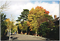

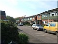
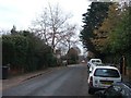
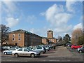
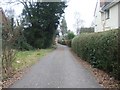
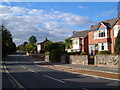


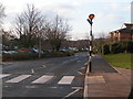
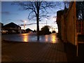
100 photos from this area
Area Information
Key information about the EX2 4SB including its size, population, and administrative classification.
- Area Type
- Postcode
- Area Size
- 4697 m²
- Population
- 2240
- Population Density
- 3637 people/km²
House Prices in EX2 4SB
15
Properties
£251,993
Average Sold Price
£132,950
Lowest Price
£430,000
Highest Price
Showing 15 properties
| Address | Type | Beds | Baths | Last Sale Price | Last Sale Date | |
|---|---|---|---|---|---|---|
| 4, The Grange, Fleming Way, Exeter, EX2 4SB | house | - | - | £430,000 | Oct 2024 | |
| 15, The Grange, Fleming Way, Exeter, EX2 4SB | Terraced | 2 | 1 | £287,000 | Mar 2022 | |
| 11, The Grange, Fleming Way, Exeter, EX2 4SB | house | - | - | £270,000 | Sep 2021 | |
| 6, The Grange, Fleming Way, Exeter, EX2 4SB | Flat | - | - | £385,000 | May 2020 | |
| 7, The Grange, Fleming Way, Exeter, EX2 4SB | Maisonette | - | - | £375,000 | Mar 2018 | |
| 9, The Grange, Fleming Way, Exeter, EX2 4SB | Flat | - | - | £200,000 | Jan 2015 | |
| 12, The Grange, Fleming Way, Exeter, EX2 4SB | Terraced | 2 | 2 | £210,000 | Sep 2013 | |
| 5, The Grange, Fleming Way, Exeter, EX2 4SB | house | 2 | - | £268,000 | Dec 2010 | |
| 3, The Grange, Fleming Way, Exeter, EX2 4SB | Flat | - | - | £210,000 | Oct 2007 | |
| 13, The Grange, Fleming Way, Exeter, EX2 4SB | house | 2 | 1 | £179,000 | Oct 2006 |
Page 1 of 2
Energy Efficiency in EX2 4SB
Amenities
Schools
| Rank | School | Type | Entry gender | Ages |
|---|
Explore more schools in this area
Go to Schools tabDemographics
Household Size
One person
most common
Accommodation Type
Houses
most common
Tenure
67
majority
Ethnic Group
White
most common
Religion
N/A
most common
Household Composition
N/A
most common
Age
47
median
Adults (30-64 years)
most common
Household Deprivation
N/A
with no deprivation
NS-SEC
51
in Lower managerial occupations
Explore more demographic insights in this area
Go to Demographics tabPlanning
Planning Constraints
- Flood RiskPremium
- Ramsar Wetland SitesPremium
- Area of Outstanding Natural BeautyPremium
- Protected Nature ReservePremium
- Protected WoodlandPremium