Area Overview for EX2 4NU
Photos of EX2 4NU
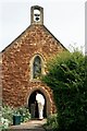

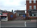
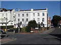
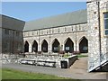

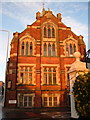

100 photos from this area
Area Information
Key information about the EX2 4NU including its size, population, and administrative classification.
- Area Type
- Postcode
- Area Size
- 3.7 hectares
- Population
- 2240
- Population Density
- 3637 people/km²
House Prices in EX2 4NU
12
Properties
£510,625
Average Sold Price
£245,000
Lowest Price
£1,200,000
Highest Price
Showing 12 properties
| Address | Type | Beds | Baths | Last Sale Price | Last Sale Date | |
|---|---|---|---|---|---|---|
| Park House, Victoria Park Road, Exeter, EX2 4NU | Detached | 5 | 4 | £1,200,000 | Apr 2020 | |
| 45 Victoria Park Road, Exeter, EX2 4NU | Bungalow | 3 | 2 | £575,000 | Nov 2017 | |
| 47 Victoria Park Road, Exeter, EX2 4NU | Bungalow | 3 | 1 | £499,000 | Aug 2015 | |
| 41 Victoria Park Road, Exeter, EX2 4NU | Bungalow | 3 | - | £450,000 | Oct 2013 | |
| 49 Victoria Park Road, Exeter, EX2 4NU | Bungalow | 2 | - | £413,000 | Feb 2012 | |
| 45A Victoria Park Road, Exeter, EX2 4NU | Bungalow | 1 | 1 | £368,000 | Dec 2010 | |
| 43 Victoria Park Road, Exeter, EX2 4NU | Bungalow | - | - | £335,000 | Aug 2009 | |
| Mulberry House, Victoria Park Road, Exeter, EX2 4NU | Detached | - | - | £245,000 | Jan 1998 | |
| Larkby, Victoria Park Road, Exeter, EX2 4NU | Flat | - | - | - | - | |
| North Wing, Mulberry House, Victoria Park Road, Exeter, EX2 4NU | undefined | - | - | - | - |
Page 1 of 2
Energy Efficiency in EX2 4NU
Amenities
Schools
| Rank | School | Type | Entry gender | Ages |
|---|
Explore more schools in this area
Go to Schools tabDemographics
Household Size
One person
most common
Accommodation Type
Houses
most common
Tenure
67
majority
Ethnic Group
White
most common
Religion
N/A
most common
Household Composition
N/A
most common
Age
47
median
Adults (30-64 years)
most common
Household Deprivation
N/A
with no deprivation
NS-SEC
51
in Lower managerial occupations
Explore more demographic insights in this area
Go to Demographics tabPlanning
Planning Constraints
- Flood RiskPremium
- Ramsar Wetland SitesPremium
- Area of Outstanding Natural BeautyPremium
- Protected Nature ReservePremium
- Protected WoodlandPremium