Area Overview for EX17 4NJ
Photos of EX17 4NJ
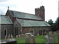
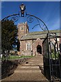
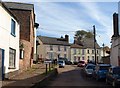
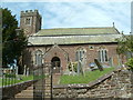
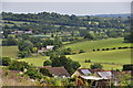
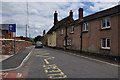
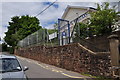
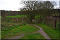

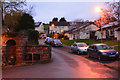
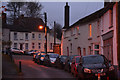
51 photos from this area
Area Information
Key information about the EX17 4NJ including its size, population, and administrative classification.
- Area Type
- Postcode
- Area Size
- 9751 m²
- Population
- 1476
- Population Density
- 34 people/km²
House Prices in EX17 4NJ
15
Properties
£175,993
Average Sold Price
£130,500
Lowest Price
£240,000
Highest Price
Showing 15 properties
| Address | Type | Beds | Baths | Last Sale Price | Last Sale Date | |
|---|---|---|---|---|---|---|
| 1 Snows, Sandford, EX17 4NJ | Terraced | 3 | 1 | £240,000 | Nov 2024 | |
| 11 Snows, Sandford, EX17 4NJ | Semi-detached | 3 | 1 | £167,500 | Jul 2017 | |
| 4 Snows, Sandford, EX17 4NJ | house | 3 | - | £159,000 | Aug 2016 | |
| Meadow View, 4B Snows, Sandford, EX17 4NJ | Detached | 2 | - | £170,000 | Jun 2014 | |
| 3 Snows, Sandford, EX17 4NJ | house | 2 | 1 | £130,500 | Jul 2011 | |
| Four & Half, 4A Snows, Sandford, EX17 4NJ | house | - | - | £165,000 | Mar 2009 | |
| 12 Snows, Sandford, EX17 4NJ | Semi-detached | - | - | £199,950 | Jul 2007 | |
| 10 Snows, Sandford, EX17 4NJ | Detached | 4 | 2 | - | - | |
| 7 Snows, Sandford, EX17 4NJ | Retail | 3 | 1 | - | - | |
| Tor House, Snows, Sandford, EX17 4NJ | Detached | 3 | 3 | - | - |
Page 1 of 2
Energy Efficiency in EX17 4NJ
Amenities
Schools
| Rank | School | Type | Entry gender | Ages |
|---|
Explore more schools in this area
Go to Schools tabDemographics
Household Size
Two person
most common
Accommodation Type
Houses
most common
Tenure
74
majority
Ethnic Group
White
most common
Religion
N/A
most common
Household Composition
N/A
most common
Age
47
median
Adults (30-64 years)
most common
Household Deprivation
N/A
with no deprivation
NS-SEC
39
in Lower managerial occupations
Explore more demographic insights in this area
Go to Demographics tabPlanning
Planning Constraints
- Flood RiskPremium
- Ramsar Wetland SitesPremium
- Area of Outstanding Natural BeautyPremium
- Protected Nature ReservePremium
- Protected WoodlandPremium