Area Overview for EX16 9RF
Photos of EX16 9RF
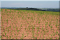
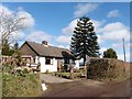
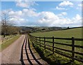
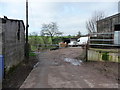
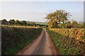
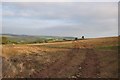
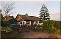

21 photos from this area
Area Information
Key information about the EX16 9RF including its size, population, and administrative classification.
- Area Type
- Postcode
- Area Size
- 3.1 km²
- Population
- 1349
- Population Density
- 20 people/km²
House Prices in EX16 9RF
28
Properties
£618,000
Average Sold Price
£300,000
Lowest Price
£900,000
Highest Price
Showing 28 properties
| Address | Type | Beds | Baths | Last Sale Price | Last Sale Date | |
|---|---|---|---|---|---|---|
| Pylemoor Flat, Road From Pilemoor Cross To Hatherland Farm, Washfield, EX16 9RF | house | - | - | £900,000 | Mar 2025 | |
| Pylemoor Farm, Road From Pilemoor Cross To Hatherland Farm, Washfield, EX16 9RF | house | 6 | 4 | £815,000 | Jul 2023 | |
| Smiths Farm, Lane Past Smiths Farm, Washfield, EX16 9RF | house | - | - | £735,000 | Jun 2021 | |
| Pylemore Lodge, Road From Pilemoor Cross To Hatherland Farm, Washfield, EX16 9RF | Bungalow | - | - | £300,000 | Dec 2019 | |
| Little Moorhayes, Lane Past Moorhayes Farm, Washfield, EX16 9RF | house | - | - | £340,000 | Oct 2009 | |
| Pylemoor Manor, Road From Pilemoor Cross To Hatherland Farm, Washfield, EX16 9RF | Detached | 6 | 4 | - | - | |
| Pylemoor Barn, Road From Pilemoor Cross To Hatherland Farm, Washfield, EX16 9RF | Detached | 4 | 2 | - | - | |
| Charterhouse, Road From Washfield Post Cross To Pilemoor Cross, Washfield, EX16 9RF | Bungalow | 3 | 1 | - | - | |
| The Hayes, Lane Past Moorhayes Farm, Washfield, EX16 9RF | Bungalow | 4 | 2 | - | - | |
| Smiths Field Farm, Lane Past Smiths Farm, Washfield, EX16 9RF | undefined | - | - | - | - |
Page 1 of 3
Energy Efficiency in EX16 9RF
Amenities
Schools
| Rank | School | Type | Entry gender | Ages |
|---|
Explore more schools in this area
Go to Schools tabDemographics
Household Size
Two person
most common
Accommodation Type
Houses
most common
Tenure
79
majority
Ethnic Group
White
most common
Religion
N/A
most common
Household Composition
N/A
most common
Age
47
median
Adults (30-64 years)
most common
Household Deprivation
N/A
with no deprivation
NS-SEC
38
in Lower managerial occupations
Explore more demographic insights in this area
Go to Demographics tabPlanning
Planning Constraints
- Flood RiskPremium
- Ramsar Wetland SitesPremium
- Area of Outstanding Natural BeautyPremium
- Protected Nature ReservePremium
- Protected WoodlandPremium