Area Overview for EX16 9JF
Photos of EX16 9JF

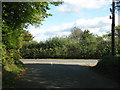
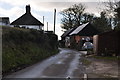
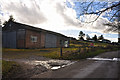

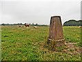
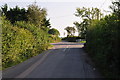
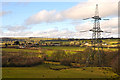
14 photos from this area
Area Information
Key information about the EX16 9JF including its size, population, and administrative classification.
- Area Type
- Postcode
- Area Size
- 25.9 hectares
- Population
- 1925
- Population Density
- 41 people/km²
House Prices in EX16 9JF
5
Properties
£297,250
Average Sold Price
£249,500
Lowest Price
£345,000
Highest Price
Showing 5 properties
| Address | Type | Beds | Baths | Last Sale Price | Last Sale Date | |
|---|---|---|---|---|---|---|
| Tregarne, Road From Tuckers Moor Cross To Woodburn Cross, East Anstey, EX16 9JF | Retail | 4 | 2 | £345,000 | Oct 2022 | |
| Devonside, Road From Tuckers Moor Cross To Woodburn Cross, East Anstey, EX16 9JF | Bungalow | 3 | - | £249,500 | Oct 2014 | |
| Piggingswood Farm, Road From Tuckers Moor Cross To Woodburn Cross, East Anstey, EX16 9JF | Land | - | - | - | - | |
| Countiesmeet Farm, Road From Tuckers Moor Cross Towards Oldways End, East Anstey, EX16 9JF | Bungalow | - | - | - | - | |
| Little Piggings, Road From Tuckers Moor Cross To Woodburn Cross, East Anstey, EX16 9JF | Mobile Home | - | - | - | - |
Energy Efficiency in EX16 9JF
Amenities
Schools
| Rank | School | Type | Entry gender | Ages |
|---|
Explore more schools in this area
Go to Schools tabDemographics
Household Size
Two person
most common
Accommodation Type
Houses
most common
Tenure
63
majority
Ethnic Group
White
most common
Religion
N/A
most common
Household Composition
N/A
most common
Age
47
median
Adults (30-64 years)
most common
Household Deprivation
N/A
with no deprivation
NS-SEC
32
in Lower managerial occupations
Explore more demographic insights in this area
Go to Demographics tabPlanning
Planning Constraints
- Flood RiskPremium
- Ramsar Wetland SitesPremium
- Area of Outstanding Natural BeautyPremium
- Protected Nature ReservePremium
- Protected WoodlandPremium