Area Overview for EX15 3LL
Photos of EX15 3LL
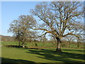
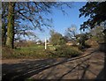
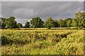
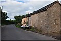
34 photos from this area
Area Information
Key information about the EX15 3LL including its size, population, and administrative classification.
- Area Type
- Postcode
- Area Size
- 4.7 hectares
- Population
- 2319
- Population Density
- 54 people/km²
House Prices in EX15 3LL
8
Properties
£764,800
Average Sold Price
£350,500
Lowest Price
£1,690,000
Highest Price
Showing 8 properties
| Address | Type | Beds | Baths | Last Sale Price | Last Sale Date | |
|---|---|---|---|---|---|---|
| Craddock Lodge, Road From Ivy Cottages To Craddock Cross, Craddock, EX15 3LL | Detached | 6 | 4 | £1,690,000 | Apr 2023 | |
| Riverside House, Road From Ivy Cottages To Craddock Cross, Craddock, EX15 3LL | house | 4 | 2 | £815,000 | Feb 2022 | |
| Butcroft, Road From Ivy Cottages To Craddock Cross, Craddock, EX15 3LL | Detached | 6 | 4 | £600,000 | Jun 2011 | |
| Cleve Cottage, Road From Ivy Cottages To Craddock Cross, Craddock, EX15 3LL | Detached | - | - | £368,500 | Aug 2010 | |
| Little Cleve, Road From Ivy Cottages To Craddock Cross, Craddock, EX15 3LL | Detached | - | - | £350,500 | Dec 2004 | |
| Tudor Lodge, Road From Ivy Cottages To Craddock Cross, Craddock, EX15 3LL | Detached | 5 | 3 | - | - | |
| Nettlebed, Road From Ivy Cottages To Craddock Cross, Craddock, EX15 3LL | house | 3 | - | - | - | |
| Pannell House, Road From Ivy Cottages To Craddock Cross, Craddock, EX15 3LL | Detached | - | - | - | - |
Energy Efficiency in EX15 3LL
Amenities
Schools
| Rank | School | Type | Entry gender | Ages |
|---|
Explore more schools in this area
Go to Schools tabDemographics
Household Size
Two person
most common
Accommodation Type
Houses
most common
Tenure
78
majority
Ethnic Group
White
most common
Religion
N/A
most common
Household Composition
N/A
most common
Age
47
median
Adults (30-64 years)
most common
Household Deprivation
N/A
with no deprivation
NS-SEC
39
in Lower managerial occupations
Explore more demographic insights in this area
Go to Demographics tabPlanning
Planning Constraints
- Flood RiskPremium
- Ramsar Wetland SitesPremium
- Area of Outstanding Natural BeautyPremium
- Protected Nature ReservePremium
- Protected WoodlandPremium