Area Overview for EX15 2SA
Photos of EX15 2SA
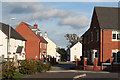
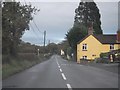

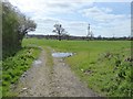
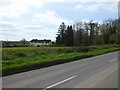

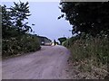
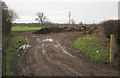
24 photos from this area
Area Information
Key information about the EX15 2SA including its size, population, and administrative classification.
- Area Type
- Postcode
- Area Size
- 66.5 hectares
- Population
- 2334
- Population Density
- 54 people/km²
House Prices in EX15 2SA
23
Properties
£236,800
Average Sold Price
£62,000
Lowest Price
£462,000
Highest Price
Showing 23 properties
| Address | Type | Beds | Baths | Last Sale Price | Last Sale Date | |
|---|---|---|---|---|---|---|
| Woodcote, Uffculme Road, Willand, EX15 2SA | house | - | - | £462,000 | Dec 2020 | |
| Springfield, Uffculme Road, Willand, EX15 2SA | Detached | 5 | 2 | £412,000 | Oct 2018 | |
| Las Flores, Uffculme Road, Willand, EX15 2SA | Detached | 4 | 2 | £395,000 | Feb 2018 | |
| Oak View House, Uffculme Road, Willand, EX15 2SA | Detached | 5 | 1 | £320,000 | Mar 2016 | |
| Beggars Bush Cottage, Uffculme Road, Willand, EX15 2SA | Detached | - | - | £137,500 | Sep 2015 | |
| Former Sunnyside, Uffculme Road, Willand, EX15 2SA | Detached | - | - | £170,000 | Nov 2012 | |
| Abcot House, Uffculme Road, Willand, EX15 2SA | Detached | 5 | 1 | £197,000 | Nov 2006 | |
| Rosejoy, Uffculme Road, Willand, EX15 2SA | Detached | - | - | £62,000 | Apr 2002 | |
| Moor Cottage, Uffculme Road, Willand, EX15 2SA | Detached | - | - | £107,500 | Jun 1998 | |
| Moorfield House, Uffculme Road, Willand, EX15 2SA | Detached | 5 | 1 | £105,000 | May 1998 |
Page 1 of 3
Energy Efficiency in EX15 2SA
Amenities
Schools
| Rank | School | Type | Entry gender | Ages |
|---|
Explore more schools in this area
Go to Schools tabDemographics
Household Size
Two person
most common
Accommodation Type
Houses
most common
Tenure
75
majority
Ethnic Group
White
most common
Religion
N/A
most common
Household Composition
N/A
most common
Age
47
median
Adults (30-64 years)
most common
Household Deprivation
N/A
with no deprivation
NS-SEC
38
in Lower managerial occupations
Explore more demographic insights in this area
Go to Demographics tabPlanning
Planning Constraints
- Flood RiskPremium
- Ramsar Wetland SitesPremium
- Area of Outstanding Natural BeautyPremium
- Protected Nature ReservePremium
- Protected WoodlandPremium