Area Overview for EX15 2RH
Photos of EX15 2RH
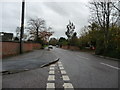
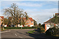
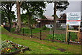
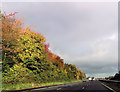

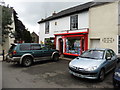

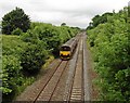
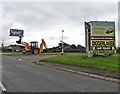
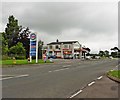
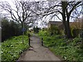
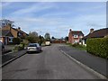
84 photos from this area
Area Information
Key information about the EX15 2RH including its size, population, and administrative classification.
- Area Type
- Postcode
- Area Size
- 2.0 hectares
- Population
- 1639
- Population Density
- 1018 people/km²
House Prices in EX15 2RH
21
Properties
£274,577
Average Sold Price
£90,000
Lowest Price
£550,000
Highest Price
Showing 21 properties
| Address | Type | Beds | Baths | Last Sale Price | Last Sale Date | |
|---|---|---|---|---|---|---|
| Church Lea, Willand Old Village, Willand, EX15 2RH | Bungalow | 3 | - | £550,000 | Mar 2022 | |
| Willow End, Willand Old Village, Willand, EX15 2RH | Bungalow | - | - | £350,000 | Dec 2021 | |
| Coombe Farm, Willand Old Village, Willand, EX15 2RH | house | - | - | £550,000 | Jan 2021 | |
| The Old School, Willand Old Village, Willand, EX15 2RH | house | 2 | - | £295,000 | Dec 2017 | |
| Oldway, Willand Old Village, Willand, EX15 2RH | house | 3 | 1 | £250,000 | Jul 2017 | |
| 5 Rectory Close, Willand, EX15 2RH | Detached | 3 | 2 | £245,000 | May 2017 | |
| Pump Cottage, Willand Old Village, Willand, EX15 2RH | Cottage | 3 | 1 | £300,000 | Nov 2015 | |
| 2 Rectory Close, Willand, EX15 2RH | Detached | 4 | 3 | £265,000 | Oct 2013 | |
| 6 Rectory Close, Willand, EX15 2RH | house | 3 | - | £217,500 | Jul 2008 | |
| 1 Rectory Close, Willand, EX15 2RH | Detached | - | - | £200,000 | May 2006 |
Page 1 of 3
Energy Efficiency in EX15 2RH
Amenities
Schools
| Rank | School | Type | Entry gender | Ages |
|---|
Explore more schools in this area
Go to Schools tabDemographics
Household Size
Two person
most common
Accommodation Type
Houses
most common
Tenure
82
majority
Ethnic Group
White
most common
Religion
N/A
most common
Household Composition
N/A
most common
Age
47
median
Adults (30-64 years)
most common
Household Deprivation
N/A
with no deprivation
NS-SEC
33
in Lower managerial occupations
Explore more demographic insights in this area
Go to Demographics tabPlanning
Planning Constraints
- Flood RiskPremium
- Ramsar Wetland SitesPremium
- Area of Outstanding Natural BeautyPremium
- Protected Nature ReservePremium
- Protected WoodlandPremium