Area Overview for EX14 9DB
Photos of EX14 9DB
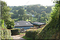
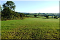
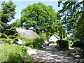
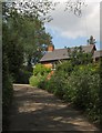
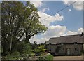
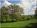
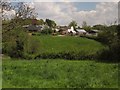
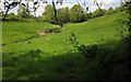

20 photos from this area
Area Information
Key information about the EX14 9DB including its size, population, and administrative classification.
- Area Type
- Postcode
- Area Size
- 34.2 hectares
- Population
- 2452
- Population Density
- 31 people/km²
House Prices in EX14 9DB
14
Properties
£546,020
Average Sold Price
£295,000
Lowest Price
£878,200
Highest Price
Showing 14 properties
| Address | Type | Beds | Baths | Last Sale Price | Last Sale Date | |
|---|---|---|---|---|---|---|
| Whitehayes, Lane To Whitehayes, Stockland, EX14 9DB | house | - | - | £725,000 | Mar 2024 | |
| Sweetlands, Lane To Mill House, Stockland, EX14 9DB | Detached | 3 | 2 | £490,000 | May 2023 | |
| Castlewell, Lane To Castelwell, Stockland, EX14 9DB | house | - | - | £475,000 | Oct 2022 | |
| Chimney Cottage, Road From Husseys Lane Junction To Venns Cottages, Stockland, EX14 9DB | Detached | 3 | 1 | £545,000 | Oct 2018 | |
| Blue Ball Lodge, Road From Husseys Lane Junction To Venns Cottages, Stockland, EX14 9DB | house | - | - | £878,200 | Oct 2017 | |
| Venus Cottage, Road From Husseys Lane Junction To Venns Cottages, Stockland, EX14 9DB | Detached | 2 | 1 | £295,000 | Mar 2016 | |
| Hunters End, Lane To Mill House, Stockland, EX14 9DB | Detached | 4 | - | £512,000 | May 2015 | |
| Brook House, Lane Past Brook House, Stockland, EX14 9DB | Detached | 4 | 3 | £585,000 | Mar 2015 | |
| Mill House, Lane To Mill House, Stockland, EX14 9DB | Cottage | 4 | - | £430,000 | Sep 2013 | |
| Millhayes Cottage, Lane To Mill House, Stockland, EX14 9DB | Detached | 4 | 3 | £525,000 | Feb 2007 |
Page 1 of 2
Energy Efficiency in EX14 9DB
Amenities
Schools
| Rank | School | Type | Entry gender | Ages |
|---|
Explore more schools in this area
Go to Schools tabDemographics
Household Size
Two person
most common
Accommodation Type
Houses
most common
Tenure
83
majority
Ethnic Group
White
most common
Religion
N/A
most common
Household Composition
N/A
most common
Age
47
median
Adults (30-64 years)
most common
Household Deprivation
N/A
with no deprivation
NS-SEC
37
in Lower managerial occupations
Explore more demographic insights in this area
Go to Demographics tabPlanning
Planning Constraints
- Flood RiskPremium
- Ramsar Wetland SitesPremium
- Area of Outstanding Natural BeautyPremium
- Protected Nature ReservePremium
- Protected WoodlandPremium