Area Overview for EX14 1XH
Photos of EX14 1XH
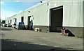
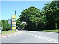
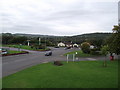

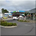

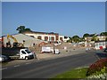
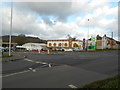
62 photos from this area
Area Information
Key information about the EX14 1XH including its size, population, and administrative classification.
- Area Type
- Postcode
- Area Size
- 4.8 hectares
- Population
- 1656
- Population Density
- 2508 people/km²
House Prices in EX14 1XH
52
Properties
£246,688
Average Sold Price
£71,850
Lowest Price
£625,000
Highest Price
Showing 52 properties
| Address | Type | Beds | Baths | Last Sale Price | Last Sale Date | |
|---|---|---|---|---|---|---|
| 18 Oaklea, Honiton, EX14 1XH | Detached | 4 | 1 | £385,000 | Aug 2025 | |
| 35 Oaklea, Honiton, EX14 1XH | Detached | 3 | 1 | £300,000 | May 2025 | |
| 41 Oaklea, Honiton, EX14 1XH | Detached | 3 | 1 | £340,000 | Dec 2024 | |
| 23 Oaklea, Honiton, EX14 1XH | Detached | 4 | 2 | £625,000 | Aug 2022 | |
| 7 Oaklea, Honiton, EX14 1XH | house | - | - | £390,000 | Jun 2022 | |
| 69 Oaklea, Honiton, EX14 1XH | Bungalow | 2 | 1 | £335,000 | May 2022 | |
| 14 Oaklea, Honiton, EX14 1XH | Bungalow | - | - | £280,000 | Mar 2021 | |
| 8 Oaklea, Honiton, EX14 1XH | Semi-detached | 2 | 1 | £215,000 | Aug 2019 | |
| 16 Oaklea, Honiton, EX14 1XH | Bungalow | 3 | 1 | £285,000 | Jul 2019 | |
| 15 Oaklea, Honiton, EX14 1XH | Bungalow | 2 | - | £252,500 | Aug 2018 |
Page 1 of 6
Energy Efficiency in EX14 1XH
Amenities
Schools
| Rank | School | Type | Entry gender | Ages |
|---|
Explore more schools in this area
Go to Schools tabDemographics
Household Size
One person
most common
Accommodation Type
Houses
most common
Tenure
47
majority
Ethnic Group
White
most common
Religion
N/A
most common
Household Composition
N/A
most common
Age
47
median
Adults (30-64 years)
most common
Household Deprivation
N/A
with no deprivation
NS-SEC
27
in Lower managerial occupations
Explore more demographic insights in this area
Go to Demographics tabPlanning
Planning Constraints
- Flood RiskPremium
- Ramsar Wetland SitesPremium
- Area of Outstanding Natural BeautyPremium
- Protected Nature ReservePremium
- Protected WoodlandPremium