Area Overview for EX13 7LU
Photos of EX13 7LU
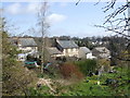
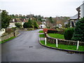
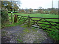
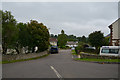
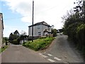
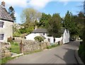

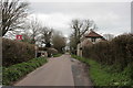
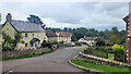
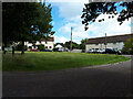
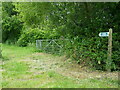
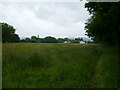
25 photos from this area
Area Information
Key information about the EX13 7LU including its size, population, and administrative classification.
- Area Type
- Postcode
- Area Size
- 27.7 hectares
- Population
- 1125
- Population Density
- 97 people/km²
House Prices in EX13 7LU
24
Properties
£356,279
Average Sold Price
£70,000
Lowest Price
£875,000
Highest Price
Showing 24 properties
| Address | Type | Beds | Baths | Last Sale Price | Last Sale Date | |
|---|---|---|---|---|---|---|
| Catmoor Cottage, Goldsmith Lane, All Saints, EX13 7LU | house | - | - | £510,000 | Mar 2021 | |
| Cheesedown, Goldsmith Lane, All Saints, EX13 7LU | Bungalow | 5 | 2 | £875,000 | Feb 2021 | |
| Poppins, Goldsmith Lane, All Saints, EX13 7LU | Land | 2 | - | £266,000 | Nov 2016 | |
| 3 Goldsmith Lane, All Saints, EX13 7LU | house | - | - | £150,000 | Oct 2011 | |
| Burrows Farm, Goldsmith Lane, All Saints, EX13 7LU | Detached | 3 | 2 | £495,000 | May 2008 | |
| 2 Goldsmith Lane, All Saints, EX13 7LU | Bungalow | 3 | 1 | £127,950 | Mar 2002 | |
| 7 Goldsmith Lane, All Saints, EX13 7LU | Semi-detached | - | - | £70,000 | May 2000 | |
| Newlands, Goldsmith Lane, All Saints, EX13 7LU | Detached | 3 | 1 | - | - | |
| Yonder Mead, Goldsmith Lane, All Saints, EX13 7LU | Bungalow | 5 | 2 | - | - | |
| 6 Goldsmith Lane, All Saints, EX13 7LU | Terraced | - | - | - | - |
Page 1 of 3
Energy Efficiency in EX13 7LU
Amenities
Schools
| Rank | School | Type | Entry gender | Ages |
|---|
Explore more schools in this area
Go to Schools tabDemographics
Household Size
Two person
most common
Accommodation Type
Houses
most common
Tenure
85
majority
Ethnic Group
White
most common
Religion
N/A
most common
Household Composition
N/A
most common
Age
47
median
Adults (30-64 years)
most common
Household Deprivation
N/A
with no deprivation
NS-SEC
38
in Lower managerial occupations
Explore more demographic insights in this area
Go to Demographics tabPlanning
Planning Constraints
- Flood RiskPremium
- Ramsar Wetland SitesPremium
- Area of Outstanding Natural BeautyPremium
- Protected Nature ReservePremium
- Protected WoodlandPremium