Area Overview for EX13 7AG
Photos of EX13 7AG


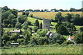


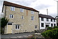

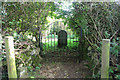
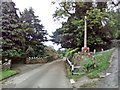
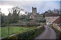

36 photos from this area
Area Information
Key information about the EX13 7AG including its size, population, and administrative classification.
- Area Type
- Postcode
- Area Size
- 58.9 hectares
- Population
- 1345
- Population Density
- 28 people/km²
House Prices in EX13 7AG
16
Properties
£388,188
Average Sold Price
£257,500
Lowest Price
£635,000
Highest Price
Showing 16 properties
| Address | Type | Beds | Baths | Last Sale Price | Last Sale Date | |
|---|---|---|---|---|---|---|
| Inglenook Cottage, Road Past Rock Farm, Membury, EX13 7AG | Detached | 3 | 2 | £635,000 | Dec 2022 | |
| Peppercorn Cottage, Road Past Rock Farm, Membury, EX13 7AG | Detached | 3 | - | £345,000 | Mar 2021 | |
| Rock House, Road Past Rock Farm, Membury, EX13 7AG | Detached | 4 | - | £450,000 | Dec 2020 | |
| Waybeares Cottage, Road Past Rock Farm, Membury, EX13 7AG | house | - | - | £449,000 | Aug 2014 | |
| The Retreat, Road Past Rock Farm, Membury, EX13 7AG | Detached | - | - | £330,000 | Jul 2007 | |
| Lane End Cottage, Lane Past Lane End Cottage, Membury, EX13 7AG | Detached | - | - | £295,000 | Dec 2004 | |
| Membury Follie, Road From Sewage Works To Wellands Cross, Membury, EX13 7AG | Detached | 2 | 1 | £344,000 | Jun 2003 | |
| Membury House, Road From Membury House To Membury Cross, Membury, EX13 7AG | Detached | - | - | £257,500 | Jan 1997 | |
| Rock Farm, Road From Sewage Works To Wellands Cross, Membury, EX13 7AG | Detached | 3 | 1 | - | - | |
| Rock Mill, Road From Sewage Works To Wellands Cross, Membury, EX13 7AG | Detached | 5 | - | - | - |
Page 1 of 2
Energy Efficiency in EX13 7AG
Amenities
Schools
| Rank | School | Type | Entry gender | Ages |
|---|
Explore more schools in this area
Go to Schools tabDemographics
Household Size
Two person
most common
Accommodation Type
Houses
most common
Tenure
76
majority
Ethnic Group
White
most common
Religion
N/A
most common
Household Composition
N/A
most common
Age
47
median
Adults (30-64 years)
most common
Household Deprivation
N/A
with no deprivation
NS-SEC
38
in Lower managerial occupations
Explore more demographic insights in this area
Go to Demographics tabPlanning
Planning Constraints
- Flood RiskPremium
- Ramsar Wetland SitesPremium
- Area of Outstanding Natural BeautyPremium
- Protected Nature ReservePremium
- Protected WoodlandPremium