Area Overview for EX13 5SQ
Photos of EX13 5SQ


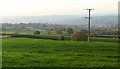
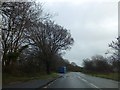
17 photos from this area
Area Information
Key information about the EX13 5SQ including its size, population, and administrative classification.
- Area Type
- Postcode
- Area Size
- 51.9 hectares
- Population
- 1736
- Population Density
- 74 people/km²
House Prices in EX13 5SQ
53
Properties
£440,061
Average Sold Price
£24,000
Lowest Price
£5,074,548
Highest Price
Showing 53 properties
| Address | Type | Beds | Baths | Last Sale Price | Last Sale Date | |
|---|---|---|---|---|---|---|
| Labrador, Cooks Lane, Axminster, EX13 5SQ | Bungalow | 2 | - | £245,000 | Jul 2020 | |
| Highview, Cooks Lane, Axminster, EX13 5SQ | Bungalow | 4 | - | £5,074,548 | May 2020 | |
| Hawthorns, Cooks Lane, Axminster, EX13 5SQ | Bungalow | - | - | £425,000 | May 2020 | |
| Steepyfields, Cooks Lane, Axminster, EX13 5SQ | Detached | - | - | £293,000 | Jan 2018 | |
| Bever Down, Cooks Lane, Axminster, EX13 5SQ | Bungalow | 3 | - | £595,000 | Oct 2017 | |
| Glendale, Cooks Lane, Axminster, EX13 5SQ | Bungalow | - | - | £390,000 | Aug 2017 | |
| Sunset View, Cooks Lane, Axminster, EX13 5SQ | house | - | - | £171,000 | Jun 2017 | |
| Greenbanks, Cooks Lane, Axminster, EX13 5SQ | Bungalow | 3 | - | £430,000 | Mar 2017 | |
| Tolcarne, Cooks Lane, Axminster, EX13 5SQ | Bungalow | 3 | 1 | £372,000 | Dec 2016 | |
| Briars, Cooks Lane, Axminster, EX13 5SQ | Bungalow | - | - | £450,000 | Oct 2016 |
Page 1 of 6
Energy Efficiency in EX13 5SQ
Amenities
Schools
| Rank | School | Type | Entry gender | Ages |
|---|
Explore more schools in this area
Go to Schools tabDemographics
Household Size
Two person
most common
Accommodation Type
Houses
most common
Tenure
79
majority
Ethnic Group
White
most common
Religion
N/A
most common
Household Composition
N/A
most common
Age
47
median
Adults (30-64 years)
most common
Household Deprivation
N/A
with no deprivation
NS-SEC
36
in Lower managerial occupations
Explore more demographic insights in this area
Go to Demographics tabPlanning
Planning Constraints
- Flood RiskPremium
- Ramsar Wetland SitesPremium
- Area of Outstanding Natural BeautyPremium
- Protected Nature ReservePremium
- Protected WoodlandPremium