Area Overview for EX13 5GT
Photos of EX13 5GT
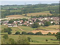
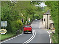
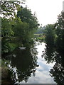
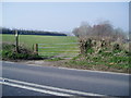


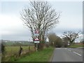
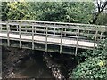
34 photos from this area
Area Information
Key information about the EX13 5GT including its size, population, and administrative classification.
- Area Type
- Postcode
- Area Size
- 2.1 hectares
- Population
- 1736
- Population Density
- 74 people/km²
House Prices in EX13 5GT
52
Properties
£279,914
Average Sold Price
£194,995
Lowest Price
£515,700
Highest Price
Showing 52 properties
| Address | Type | Beds | Baths | Last Sale Price | Last Sale Date | |
|---|---|---|---|---|---|---|
| 31 Cloakham Drive, Axminster, EX13 5GT | Detached | 4 | 2 | £410,000 | Jun 2025 | |
| 69 Cloakham Drive, Axminster, EX13 5GT | house | - | - | £442,500 | Jul 2024 | |
| 23 Cloakham Drive, Axminster, EX13 5GT | Maisonette | 2 | 1 | £200,000 | Dec 2023 | |
| 29 Cloakham Drive, Axminster, EX13 5GT | Terraced | 3 | 2 | £317,000 | Mar 2022 | |
| 25 Cloakham Drive, Axminster, EX13 5GT | Terraced | 3 | 2 | £285,000 | Sep 2021 | |
| 73 Cloakham Drive, Axminster, EX13 5GT | Flat | - | - | £515,700 | Oct 2020 | |
| 17 Cloakham Drive, Axminster, EX13 5GT | Detached | 4 | 2 | £372,500 | Jul 2020 | |
| 71 Cloakham Drive, Axminster, EX13 5GT | house | - | - | £349,995 | Jan 2020 | |
| 35 Cloakham Drive, Axminster, EX13 5GT | Detached | 4 | 2 | £290,796 | Dec 2018 | |
| 39 Cloakham Drive, Axminster, EX13 5GT | house | - | - | £290,796 | Dec 2018 |
Page 1 of 6
Energy Efficiency in EX13 5GT
Amenities
Schools
| Rank | School | Type | Entry gender | Ages |
|---|
Explore more schools in this area
Go to Schools tabDemographics
Household Size
Two person
most common
Accommodation Type
Houses
most common
Tenure
79
majority
Ethnic Group
White
most common
Religion
N/A
most common
Household Composition
N/A
most common
Age
47
median
Adults (30-64 years)
most common
Household Deprivation
N/A
with no deprivation
NS-SEC
36
in Lower managerial occupations
Explore more demographic insights in this area
Go to Demographics tabPlanning
Planning Constraints
- Flood RiskPremium
- Ramsar Wetland SitesPremium
- Area of Outstanding Natural BeautyPremium
- Protected Nature ReservePremium
- Protected WoodlandPremium