Area Overview for EX12 2TT
Photos of EX12 2TT
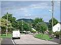
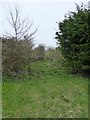
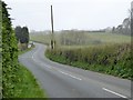
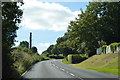
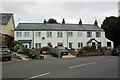
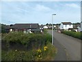
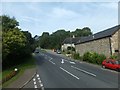
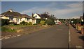
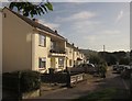
25 photos from this area
Area Information
Key information about the EX12 2TT including its size, population, and administrative classification.
- Area Type
- Postcode
- Area Size
- 1.5 hectares
- Population
- 1593
- Population Density
- 787 people/km²
House Prices in EX12 2TT
43
Properties
£184,494
Average Sold Price
£32,000
Lowest Price
£317,000
Highest Price
Showing 43 properties
| Address | Type | Beds | Baths | Last Sale Price | Last Sale Date | |
|---|---|---|---|---|---|---|
| 10 Ash Grove, Seaton, EX12 2TT | Semi-detached | 1 | 1 | £180,000 | Dec 2024 | |
| 24 Ash Grove, Seaton, EX12 2TT | Bungalow | 2 | 1 | £206,000 | Sep 2024 | |
| 2 Ash Grove, Seaton, EX12 2TT | Bungalow | 2 | 1 | £317,000 | Jun 2024 | |
| 28 Ash Grove, Seaton, EX12 2TT | Semi-detached | 2 | 1 | £208,000 | Sep 2022 | |
| 16 Ash Grove, Seaton, EX12 2TT | Semi-detached | 1 | - | £192,000 | Feb 2022 | |
| 34 Ash Grove, Seaton, EX12 2TT | Bungalow | 2 | 1 | £175,000 | Mar 2021 | |
| 23 Ash Grove, Seaton, EX12 2TT | Bungalow | 2 | - | £255,000 | Nov 2020 | |
| 9 Ash Grove, Seaton, EX12 2TT | Bungalow | 2 | 1 | £270,000 | Jun 2020 | |
| 49 Ash Grove, Seaton, EX12 2TT | house | 4 | - | £277,500 | Mar 2019 | |
| 11 Ash Grove, Seaton, EX12 2TT | Bungalow | 2 | 1 | £278,000 | Sep 2018 |
Page 1 of 5
Energy Efficiency in EX12 2TT
Amenities
Schools
| Rank | School | Type | Entry gender | Ages |
|---|
Explore more schools in this area
Go to Schools tabDemographics
Household Size
Two person
most common
Accommodation Type
Houses
most common
Tenure
84
majority
Ethnic Group
White
most common
Religion
N/A
most common
Household Composition
N/A
most common
Age
47
median
Elderly (65+ years)
most common
Household Deprivation
N/A
with no deprivation
NS-SEC
32
in Lower managerial occupations
Explore more demographic insights in this area
Go to Demographics tabPlanning
Planning Constraints
- Flood RiskPremium
- Ramsar Wetland SitesPremium
- Area of Outstanding Natural BeautyPremium
- Protected Nature ReservePremium
- Protected WoodlandPremium