Area Overview for EX12 2BT
Photos of EX12 2BT
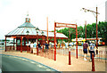
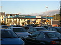
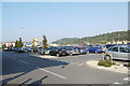
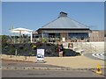
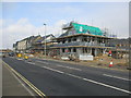
100 photos from this area
Area Information
Key information about the EX12 2BT including its size, population, and administrative classification.
- Area Type
- Postcode
- Area Size
- 2921 m²
- Population
- 1270
- Population Density
- 2133 people/km²
House Prices in EX12 2BT
7
Properties
£227,929
Average Sold Price
£145,000
Lowest Price
£310,000
Highest Price
Showing 7 properties
| Address | Type | Beds | Baths | Last Sale Price | Last Sale Date | |
|---|---|---|---|---|---|---|
| 83 Harepath Road, Seaton, EX12 2BT | Semi-detached | 3 | 1 | £310,000 | Jun 2024 | |
| 89 Harepath Road, Seaton, EX12 2BT | Retail | 4 | 1 | £300,000 | Nov 2022 | |
| 91 Harepath Road, Seaton, EX12 2BT | Semi-detached | 3 | - | £267,500 | Feb 2021 | |
| 87 Harepath Road, Seaton, EX12 2BT | Semi-detached | 3 | 1 | £225,000 | Sep 2017 | |
| 81 Harepath Road, Seaton, EX12 2BT | Semi-detached | - | - | £168,000 | Oct 2012 | |
| 93 Harepath Road, Seaton, EX12 2BT | house | 3 | - | £180,000 | Feb 2012 | |
| 95 Harepath Road, Seaton, EX12 2BT | Detached | - | - | £145,000 | Aug 2001 |
Energy Efficiency in EX12 2BT
Amenities
Schools
| Rank | School | Type | Entry gender | Ages |
|---|
Explore more schools in this area
Go to Schools tabDemographics
Household Size
Two person
most common
Accommodation Type
Houses
most common
Tenure
62
majority
Ethnic Group
White
most common
Religion
N/A
most common
Household Composition
N/A
most common
Age
47
median
Elderly (65+ years)
most common
Household Deprivation
N/A
with no deprivation
NS-SEC
29
in Lower managerial occupations
Explore more demographic insights in this area
Go to Demographics tabPlanning
Planning Constraints
- Flood RiskPremium
- Ramsar Wetland SitesPremium
- Area of Outstanding Natural BeautyPremium
- Protected Nature ReservePremium
- Protected WoodlandPremium