Area Overview for EX11 1SP
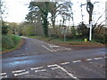
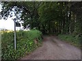
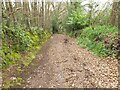
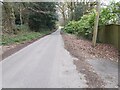
Photos of EX11 1SP


Area Information
Living in EX11 1SP means inhabiting a small, tightly knit residential cluster in England. The area covers 6.5 hectares and is home to 1,734 residents, giving it a population density of 121 people per square kilometre. This compact community is characterised by a quiet, suburban feel, with a strong emphasis on home ownership. The area’s appeal lies in its balance of accessibility and tranquillity, with nearby rail links and retail options within easy reach. Daily life here is shaped by the presence of local schools, a low crime rate, and a demographic skewed toward middle-aged adults. The absence of major environmental constraints, such as protected woodlands or wetlands, means residents face few planning restrictions. While the area is small, it offers a sense of stability, with most properties being owner-occupied and the community largely composed of long-term residents. For those seeking a peaceful yet connected lifestyle, EX11 1SP provides a straightforward, low-maintenance environment.
- Area Type
- Postcode
- Area Size
- 6.5 hectares
- Population
- 1734
- Population Density
- 121 people/km²
The property market in EX11 1SP is overwhelmingly owner-occupied, with 91% of homes owned by residents rather than rented. This suggests a stable, long-term community with little turnover in the housing stock. The area is composed almost entirely of houses, with no mention of flats or apartments, indicating a focus on traditional family homes. The small size of the area—just 6.5 hectares—means the housing stock is limited, and buyers should expect a competitive market for available properties. The high home ownership rate also implies that rental options are scarce, making this a less viable area for investors seeking rental income. For buyers, this means a focus on purchasing established homes rather than speculative development. The lack of planning constraints, such as protected areas or flood risks, further supports the appeal of a straightforward, low-maintenance property purchase.
House Prices in EX11 1SP
Showing 1 properties
| Address | Type | Beds | Baths | Last Sale Price | Last Sale Date | |
|---|---|---|---|---|---|---|
| Downs, Road To Cottage Pie, Higher Metcombe, EX11 1SP | Detached | 5 | 4 | £750,000 | Jul 2004 |
Energy Efficiency in EX11 1SP
The lifestyle in EX11 1SP is shaped by its proximity to essential amenities. Residents have access to five retail outlets, including Morrisons Daily Ottery St, Sainsburys Ottery, and Budgens Greendale, providing convenience for grocery shopping and daily essentials. The three nearby railway stations—Whimple, Feniton, and Cranbrook—offer regular commuting options, while Exeter International Airport is within reach for those requiring air travel. Though the data does not mention parks or leisure facilities, the absence of environmental constraints like protected woodlands or wetlands suggests open spaces may be available for recreation. The area’s small size means amenities are tightly clustered, reducing the need for long commutes. This combination of retail, transport, and regional connectivity creates a practical, low-stress lifestyle, ideal for those prioritising convenience over sprawling urban amenities.
Amenities
Schools
Residents of EX11 1SP have access to two primary schools within practical reach: West Hill Primary School and Tipton St John Church of England Primary School. Both institutions hold an Ofsted rating of 'good', reflecting a standard of education that meets or exceeds national benchmarks. The presence of two primary schools provides families with options for their children’s early education, though no secondary schools are listed in the data. This suggests that parents may need to consider commuting to nearby towns for secondary education. The 'good' ratings indicate that the schools are performing adequately, with no immediate concerns about quality. For families prioritising proximity to schools, the availability of two primary options within walking or short driving distance is a practical advantage.
| Rank | School | Type | Entry gender | Ages |
|---|
Explore more schools in this area
Go to Schools tabDemographics
The population of EX11 1SP has a median age of 47, with the majority of residents aged between 30 and 64. This suggests a community of established professionals and families, rather than a transient or student population. Home ownership is exceptionally high at 91%, indicating a strong preference for long-term residency over rental living. The area is predominantly composed of houses, with no data suggesting the presence of flats or apartments. The predominant ethnic group is White, with no specific figures provided for other groups. The low population density of 121 people per square kilometre implies a spread-out, less congested living environment. While no explicit deprivation data is available, the high home ownership and stable age profile suggest a relatively affluent and settled community. This demographic profile aligns with a lifestyle prioritising stability over rapid change.
Household Size
Accommodation Type
Tenure
Ethnic Group
Religion
Household Composition
Age
Household Deprivation
NS-SEC
Explore more demographic insights in this area
Go to Demographics tabPlanning
Planning Constraints
- Flood RiskPremium
- Ramsar Wetland SitesPremium
- Area of Outstanding Natural BeautyPremium
- Protected Nature ReservePremium
- Protected WoodlandPremium